 简体中文
简体中文 English
 繁体中文
繁体中文


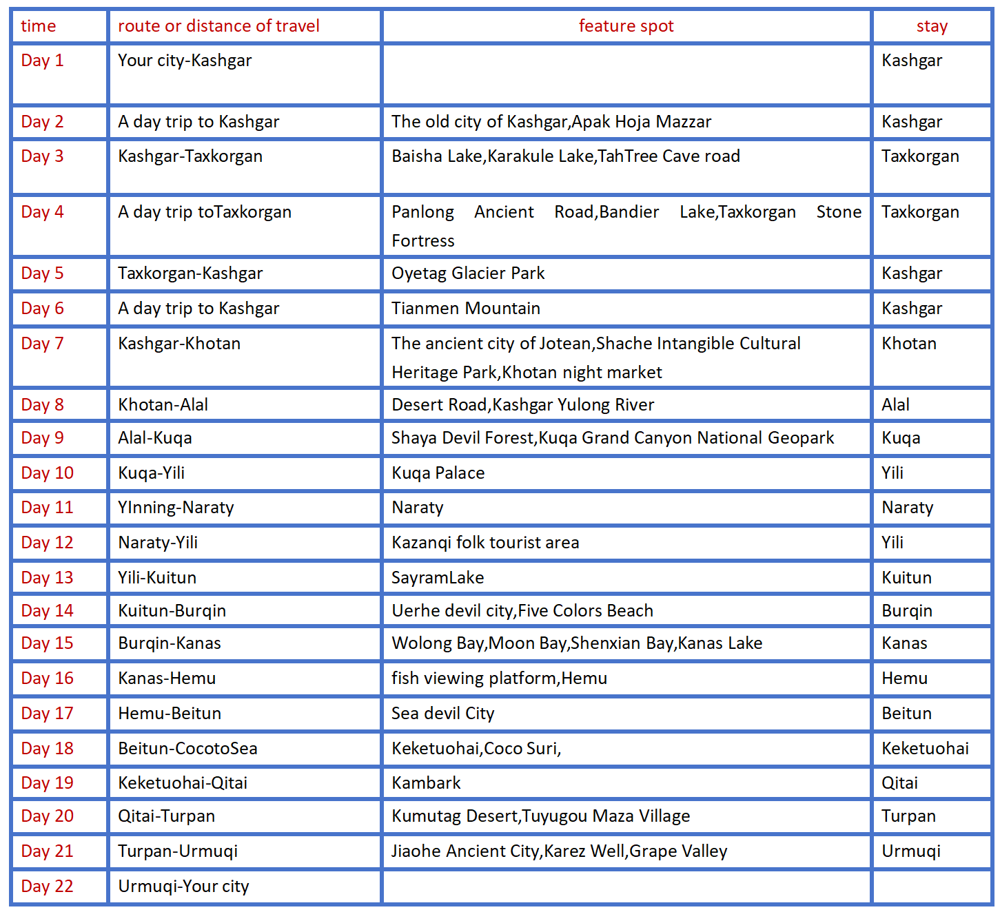
Southern and Northern Xinjiang big ring road 22 days tour
{{item.d}}
¥{{form[item.str].price || 0}}
剩余:{{form[item.str].total || 0}}
Booking process

Overview of itinerary
Product Manager recommendation
Over the course of 22 days,we will embark on a picturesque journey through Xinjiang,starting from Kashgar,Our journey will traverse plains and plateaus,cross grasslands and lakes,and visit both cities and villages. We will take in the stunning natural scenery and immerse ourselves in the captivating landscapes of Xinjiang together!
Highlights
● Enter the world's most beautiful grassland - Naraty grassland,free yourself on the grassland!
● In the Jade Dragon River in Kashgar visitors can experience the joy of jade pickers.
● At the foot of the Tian Shan Mountains,feel the magical power of the convergence of the mountain ranges.
● Stand on the shore of the White Sand Lake and feel the fine white sand and soft breeze.
● Cross the Panlong Ancient Road,enter the Pamir Plateau,erase all troubles!
Travel overview
Detailed itinerary
Day 1 Your city-Kashgar
Itinerary
Welcome to Damei Xinjiang! A professional pickup team will arrange the pickup / train to take you to the hotel for rest. If the time allows you to visit the recommended scenic spots by yourself (excluding a separate car). The departure time of the next day will be informed by the driver and the housekeeper with a message or telephone call before 22:00 PM. Please pay attention to check.
kindly reminder:1.Xinjiang is very large,scenic spots between a long drive,tourism is very physical energy,please bring some food or snacks,in case of emergency;
2.There is a two-hour time difference between Xinjiang and inland,breakfast in Xinjiang is around 8-9,lunch around 14 and dinner around 20. For better travel,I hope you can adjust your biological clock to the time difference in Xinjiang as soon as possible;
3.according to the arrival time,arrange the nearest border pass. So as not to affect the next day,if the arrival time is too late,please handle it in the local.
Day 2 A day trip to Kashgar
Today's scenic spot:
The old city of Kashgar
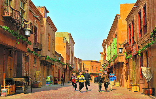
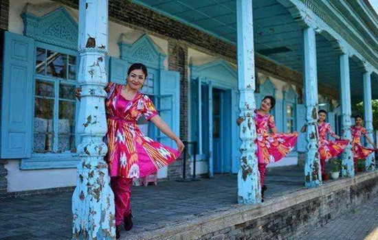
Strange natural scenery,rich ethnic customs,brilliant historical district road roadway,a little wider can walk donkey cart,narrow two people side by side; the street elderly more than 600 meters,short 50 meters short to the end. Streets and lanes east turn west fold,south bend north wrong,twists and turns,seemingly all the road,but then see a lane,just like All Men Are Brothers Zhujiazhuang Pantuo Road. On both sides of the roadway are a Uyghur house. The residential houses are very characteristic. Generally,people build two to three layers of civil structure on a limited plane,and some extend down and build basements. Living room and bedroom are connected by wooden escalators and stairs. Every house has a drying table,located on the flat roof. Each household has a small courtyard for growing flowers or placing bonsai. Bonsai,flowers and building pillars,wood carvings,eaves on the eaves of flowers complement each other,strewn at random,quiet and fresh. Sometimes at the junction of the two alleys,there will encounter a small building across the street,like a porch,so that the alley adds a bit of simplicity and depth. Walking up narrower and narrower alleys,walking through higher and taller houses,I came to a Uighur family in Ziliqi Lane. According to the introduction,this house is built in the top of the old block. After entering the door,the foot steps on the wooden ladder,step up,climb to the roof ridge,the eyes suddenly open,really have "see all the houses short" feeling. Even the distant tall buildings,as if only at the feet.
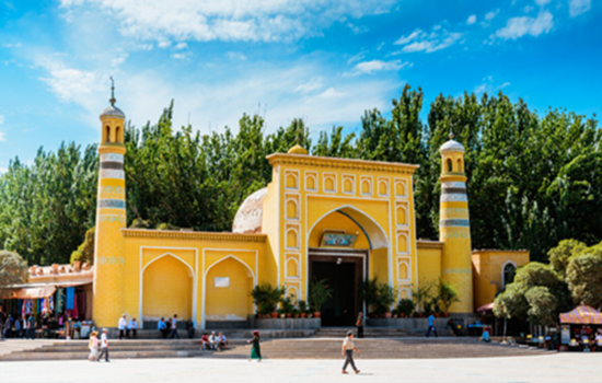
Apak Hoja Mazzar
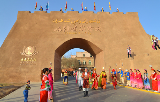
The scenic spot tells the story of hometown,former residence and the fragrant princess from birth to death,from Kashgar to Beijing,from the fragrant princess to thousands of pet."Happy Apak Hoja Mazzar,love card,here,will let you deeply understand the love story of fragrant concubine. Experience Kashgar's characteristic customs and folk culture from zero distance.
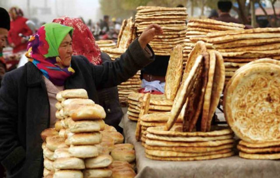
Scenic area with tourist service center,sweet princess stone,sweet princess welcome ceremony,the western folk cultural center,sweet princess,folk wedding,ancient water mill,love tree,sweet princess relief wall,treasure,smell pavilion,mirror pool,orchard,oil press,kashgar old bazaar,called naan shop,sweet princess gallery,intangible exhibition,TikTok beauty base,etc.
Itinerary
You can feel the unique charm of the most famous ancient city in southern Xinjiang. See the kaesong ceremony,ethnic song and dance,eat steamed stuffed bun,eat pure handmade ice cream,go to the century-old teahouse tea... or sitting in the sightseeing car,shuttle in the crisscross roadway,leisurely,enjoy the jade,bronze,flower hat,ethnic instrument shop,the unique scenery line must make you busy.
Friends who are interested in visiting Adigah Mosque can go by themselves,and then follow the century-old street next to the mosque into the Xicheng district of Kashgar old city,and go to the century-old teahouse,Rainbow Lane,Bag Lane and other web celebrity punch points to take photos.
It is a colorful scroll; It is a touching ballad; it is a passionate legend,beauty,folk dance,love legend to welcome.
kindly reminder:
Today is the rest day. If you do not follow the group activities on that day,you should explain to the accompanying driver to arrange it by yourself in advance.
Day 3 Kashgar-Taxkorgan (about 300KM)
Today's scenic spot:
Baisha Lake
Baisha Lake is a scenic spot that has gradually begun to enter people's sight in recent years. Baisha lake is scattered with the white sand,and the distance around the lake is the snow-capped mountains. The whole Baisha Lake is surrounded by the surrounding snow mountains,around the tall snow mountains like a kind "mother" guarding this plateau lake,so that it will not be disturbed by the outside world.
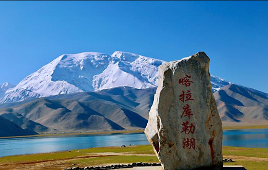
Kharakule Lake
To the east of the lake stands the "father of the glacier",the peak,to the west; the south of the lake is the grassland,a summer comes,the clear grass,the lake,green grass,a white felt dotted,and the reflection of the lake,as in the ancient poem "wind grass low see cattle and sheep". Pastoral songs on the grassland,the wild duck on the lake,this scene,like a dream,no wonder even the 10th century BC Zhou King Mu so far also sighed,feeling.
Itinerary
On the shore of Baisha Lake,there is a large area of high mountains,hills and rolling mountains. High mountain is sand mountain,sand mountain is silver white,silver white fine sand white soft,like white silk. More than 10 hills composed of the Baisha Mountain winding more than 10 kilometers. The snow light in the distance reflects the Baisha Lake,and the grass planting by the Baisha Lake reflects the Baisha Mountain.
The Karakule Lake is full of water and grass,with thousands of water birds and wild ducks swimming,and sometimes the opposite swans are playing in the water. Besides the grass beside the lake,there is no creature in the lake,especially the lake constantly changes various colors throughout the day,which is confusing.
On the way you will pass by Tahman Wetland Park. The tall willows on both sides of the road interweave into arches,leading to the front until the towering snow-capped mountains and blue sky in the distance. Driving through it,as if through the fantasy space tunnel,this inexplicable shuttle sense,only once to experience。
kindly reminder:
1. This trip will pass by Daban at the highest altitude of 4000 meters. If friends who have high anti experience start to drink Rhodiola or other preventive drugs 15 days in advance,they can also prepare oxygen bags / bottles in advance. Plateau area,please pay attention to the body,reasonable diet,avoid strenuous exercise,beware of altitude sickness;
2. Keep slow,calm,avoid fast running or other sports,and try not to drink in Tacheng. Ta County is located in the plateau,tourism reception facilities are backward,the hotel standard is low,cold prevention is not recommended to take a bath,please understand; do not close the bathroom door,if discomfort,please seek medical advice in time;
3. today's driving speed limit,the speed will be very slow,please understand more;
4. No photos or video recordings can be taken along the checkpoints;
5. Before departure in the morning,please take out the thick clothes and put them on your side. The temperature drops after reaching the plateau,and please be ready to add clothes at any time.

Day 4 A day trip toTaxkorgan township (about 160 KM)
Today's attractions:
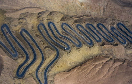
Panlong ancient road
The road,named Wacha Highway,is one of the two roads leading to Wacha Township,Ta County. Although the road is difficult,it can greatly shorten the distance and the time between the county in and out of the county. Because this road is like a dragon dragon lying on the mountain,so named "Panlong Ancient Road".
The most challenging is the small pan dragon with dense curves,just like a hair card worn on the girl's head,winding,neat,as the saying goes,"today through all the detours of life,from now on life is smooth"
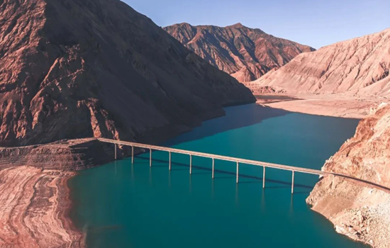
Bandier Lake
In different weather,not after time,different seasons and different light,the lake will produce different colors,sometimes may be dark blue,sometimes is light blue or Tiffany color,color diversity more than white sand lake and kara library lake,better luck,encounter no wind,the mountain on both sides of the lake will completely reflected on the lake. Very beautiful. Bandier Lake was originally a river,built as a reservoir for water storage. The lake is glacial melt water because the special minerals are blue. It is blue blue in summer and dark blue in winter.
Taxkorgan Stone Fortress
The Taxkorgan Stone Fortress includes Stone City and Golden Grass Beach.
The stone city castle is built on a high hill,and the situation is extremely steep. Outside the city,there are multi-storey or broken or continuous walls,overlapping stone hills between the walls and piles of stones,forming a unique stone city scenery. In the Han Dynasty,it was the king city of Puli State,one of the 36 states in the Western Regions. After the Tang Dynasty unified the Western Regions,there was a green here. At the beginning of the Yuan Dynasty,the city was greatly expanded,and the old stone city was changed into a new face. In the 28th year of Guangxu,the Qing Dynasty established the Bo Hall and repaired and supplemented the old castle.
Jincao Beach is on the Alar grassland below the Stone City. The construction contents include the Silk Road Castle Square,the Stone City cultural wall,performing arts square,landscape column,Naxi viewing platform,the ancient city sunset stand,the grandstand,Yongquan stand,the water platform,the wooden plank road,the 50-meter breathtaking suspension bridge,sightseeing water wheel and other scenery.
Itinerary
Panlong road also known as tile just highway,total length of more than 70 kilometers,people are divided into big panlong and small panlong,including small panlong about 30 kilometers long,from 3000 meters to 4100 meters,the drop of more than 1100 meters,so the 30 kilometers of mountain road appeared 639 corners,and basic is more than 180 degrees a S bend,the road is a test for the driver. Someone joked: opened this road,other roads are floating clouds.
Bandier Lake is a free scenic spot on the road back to Ta County,quiet and beautiful Bandier blue Lake,like a blue clear plateau pearl,walking along the road beside the river,you will see a bridge on the lake,the scenery here is the most beautiful.
Check in the hotel for a break and go to the Taxkorgan Stone Fortress. Here is also known as the Stone City,although only the ruins remain,but there are snow peaks around it,grass beaches,rivers,and strong Tajik ethnic customs,quite rugged and unrestrained beauty. After visiting the stone city to the opposite side of the road is the Jincaobeach wetland,walk along the plank road while playing about an hour to the interval bus boarding point,to the scenic area near the entrance of the Caiyun family.
kindly reminder:
1.there are not many dining places along the way,please bring dry food or snacks in advance for emergency needs;
2.tonight's hostel is a large bunk,the accommodation is only divided into men and women,there may be no independent standard room,only public bathroom,please prepare mentally in advance.
Day 5 Taxkorgan-Kashgar (300KM)
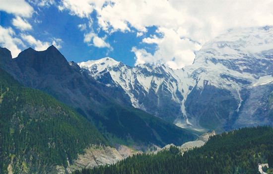
Today's attractions: Oyetag Glacier Park
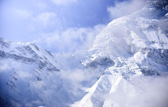
Otak Glacier Park is an ancient Turkic word meaning "a depression among the mountains". With an annual average temperature of 7.8°C,surrounded by mountains on three sides,steep snow-capped peaks,vertical glaciers and dense trees,it is praised as "the first natural ecological landscape in the Western Regions" by geological experts. The most interesting is one of the world's most rare low latitude modern glaciers in the-Its Klaze Glacier,which is only 2804 meters above sea level,is the lowest altitude glacier in China. In summer,avalanches often occur on the snow-capped mountains above the glacier,witnessing a stunning natural spectacle from the viewing platform.
Itinerary
The snow mountains,glaciers,waterfalls,rivers,avalanche,grassland,plus herds of cattle and sheep on the hillside and the round yurt of Kirgiz herdsmen on the hillside,make this great and holy virgin land full of natural beauty,without a trace of artificial carving,everything is pure natural.
kindly reminder:
1. Oyetag Glacier Park needs to hike to the viewing platform,please do anything and pay attention to safety!
2. You need to take off your shoes to visit it. If you are clean or do not want to take off your shoes,please prepare disposable shoe covers in advance.
Day 6 Kashgar (about 150KM)
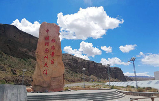
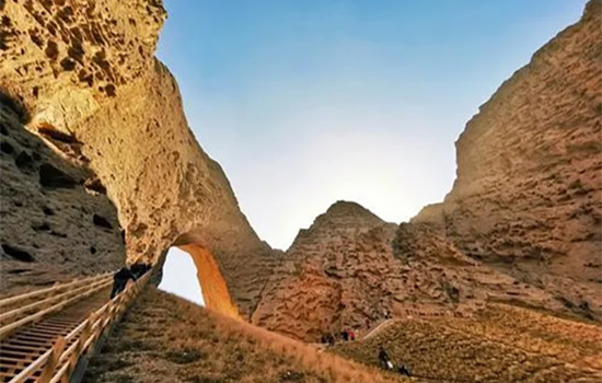
Today's attractions: Tianmen Mountain
The earliest modern human record appeared in 1932. At that time,the American journalist xiaheluo arrived in the area accompanied by a local guide. In 1947,the British explorer Eric Shipton also visited the place and named it Shipton stone arch. In 2005,Atushi Tianmen was rated as one of the twenty routes worth exploring in the world,attracting many domestic and foreign tourists to explore and experience.
Itinerary
Today is a day to enjoy hiking.There is no complete road inside the scenic area,so you can only enter on foot. The scenery along the way and the final destination are both very beautiful. If the end time is early,you can still enjoy your free time when you return to the city center of Kashgar.
kindly reminder:
You must have a comfortable pair of shoes. Before entering the scenic area,please prepare sufficient water and food,and pay attention to safety!
Day 7 Kashgar-Khotan (about 500KM)
Today's attractions:
The ancient city of Jotean
The culture of ancient Yutian is the soul of the project. Based on the historical records of the ancient state of Khotan,the builders have compiled more than 700,000 words. The architectural style has basically restored the square city,the white Ayawang residence,the Sumi fort,and the Seven Phoenix Pagoda recorded in the historical books.
The city is based on folk culture and historical relics,based on the variety of traditional delicacies,handicrafts,bazaar and traditional festivals,and a combination of historical facts and story interpretation,telling the charm of the ancient city of thousands of years.
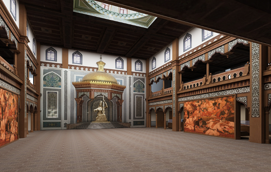
Shache Intangible Cultural Heritage Park
Also known as the Khan Palace,with blue as the keynote,thick Central Asian customs,as if through the prosperity of thousands of years ago. There are also several small exhibition halls,introducing the traditional customs of the Tajik,Kirgiz and Uygur people,as well as the exhibition halls of the Twelve Mukam,Adeles and so on.....
Khotan night market
Khotan Night Market is located in Renmin West Road,covering an area of 4600 square meters,with a narrow and closed greenhouse space,a total length of 272 meters,very neatly placed according to the two sides,a total of 260 stalls,it is said that there are more than 100 varieties of food here. Here as long as you want to eat things can find,everywhere,all kinds of flavors,everything,the variety is amazing.
Itinerary
During the day,the theme of the old city is "ten party hundred plays",showing the solemn post changing ceremony of the old city,the millet caravan and the folk customs on the ancient Silk Road.
At 12 pm and 16:30 pm,12 Muqam is a traditional Uyghur musical performance,and the performers will be invited to dance together.
kindly reminder:
1. Jotean Ancient City is a newly developed tourist attraction in Hotan area,which is very different from other ancient cities in appearance and color. Take photos and punch in to prepare brightly colored clothes.
2. There is a fixed time for davazi performance in Shar Intangible Cultural Heritage Park. If there is no plan in advance,you may miss the performance.

Day 8 Khotan-Alal (about 420KM)
Today's attractions:
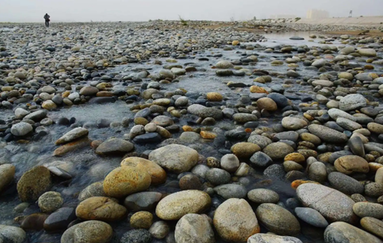
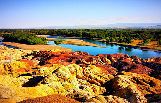
Kashgar Yulong River
Starting from the Kunlun mountains and the Tarim Mountains,it joins and joins the Karrakash River in the west. The river is 325 kilometers long,has many tributaries,and has a basin area of 14,500 square kilometers. The river is rich in white jade,green jade and ink jade,since ancient times is the main river of Khotan jade. Also known as white Jade River,it is a river in Hotan region of Xinjiang,China.
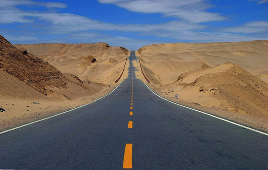
Desert Road
Tarim Desert Highway,located in the center of Tarim Basin in southern Xinjiang,is the largest desert in China and the second largest flowing desert in the world,second only to the Sahara Desert,and is known as the first "desert green corridor" in the world.
The road is like a long black dragon swimming in the vast sand sea,stretching along the dune lowland,becoming a unique landscape in the Taklimakan Desert.
Itinerary
Along the desert highway from Alal to Hotan,you pass sand dunes,poplar forests,dry riverbeds and desert villages along the way,which is a different scenery of southern Xinjiang.
Arrive at the famous Yulong Kashi River,also known as the White Jade River,and see if you have any luck picking up the heirloom white jade of Khotan goat fat!
After checking into the hotel,you can have a rest and go to Hotan Night Market according to the actual schedule to taste local specialties.
kindly reminder:
1. Yulong Kashi River visitors can experience the happiness of jade pickers,walking on the cobblestone river bed must pay attention to safety;
2. the road is far today,you can bring some snacks,fruits,etc.,with enough water,it is not good to buy along the way.
Day 9 Alal-Kuqa(about 300KM)
Today's scenic spot:
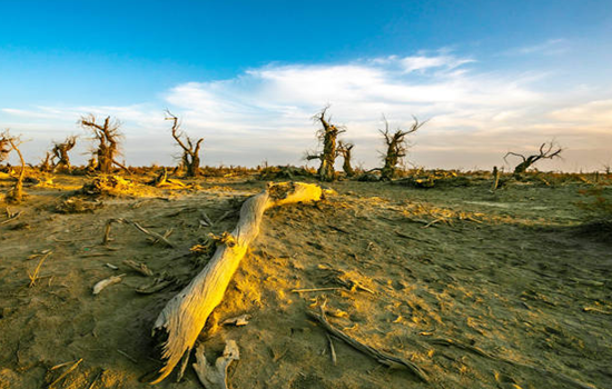
Shaya Devil forest
The devil's forest is on the edge of the Taklimakan Desert,where the soil is soft sand,walking through the woods,sometimes the whole foot into the sand. Here,you will have a strong sense of thirst,the color is also a single earth gray,only to look carefully,to see a red willow or two scattered on some raised sandbags,showing a little green.
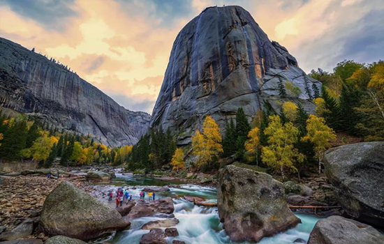
Tianshan mysterious Grand Canyon
The mysterious Grand Canyon is in the landscape of Kizilla,one of the nine film and television bases in China. The huge red mountain group was formed in the Mesozoic Cretaceous period 140 million years ago,after millions of years of wind and rain erosion,flood erosion,forming a crisscross,orderly ridge and groove,far look picturesque,like "Potala Palace",fairy day Qiongge; close look like people like things,like a dream,lifelike,charming. It is uncanny workmanship,the wonder of heaven into the lament.
Itinerary
There are many dead poplar trees in shaya Devil Forest scenic area,which is the product of the Tarim River riverbed diversion,and few tourists in the small scenic area can play slowly.
Visit the mysterious Kuqa Grand Canyon National Geopark,where the valley side of the rocky peaks,competing to rise; overlapping peaks,sky,cliff,majestic magic. The scenic area depends on hiking and must go back,according to their own actual situation,pay attention to control the round-trip time.
kindly reminder:
1. Tianshan mysterious Grand Canyon scenic area should pay attention to the safety of the foot,are gravel road,wear convenient walking shoes are more suitable; some places have limited traffic conditions need to queue through,walk without seeing the scene.
2. If the Kuqa Grand Canyon National Geopark is prone to flood in rainy days,please follow the management of the scenic spot and refund the tickets when you cannot visit it.
3. Salt ditch section parking photos must stop in a safe area,should be careful when crossing the road.

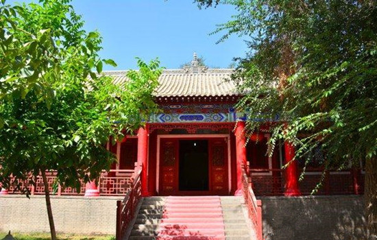
Day 10 Kuqa-Yili(Airplane)
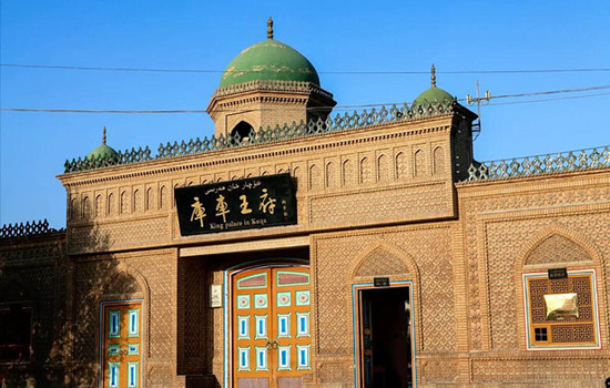
Today's attractions: Kuqa Palace
There are Qiuci Museum,Kuqa Palace cultural relics hall,Kuqa folk custom exhibition hall,the last "Kuqa king" official Tai Qing Dynasty city wall and so on. Visitors can learn about the 190 years of the hereditary "Kuqa King" through the exhibition of cultural relics,family history and special diet.
Kuqa Palace is a large area,about two or three hundred meters,there are many buildings inside,most of the buildings are Uyghur style,colorful interior,you can take photos everywhere,there are gardens and green space in the courtyard,the environment is very good. The palace visit is divided into three places: the Qiuci cultural exhibition area,the Wangfu visit area and the old city wall. After entering,you can walk to visit,generally about 2 hours is appropriate. The Qiuci cultural exhibition area shows the cultural customs of Qiuci country in the history of Xinjiang. There are many text and pictures,the precious cultural relics of Qiuci Buddhism,and the production tools,coins and folk handicraft relics of the ancient country.
Itinerary
The old city wall of Kuqa Palace is an ancient building in the palace. You can have a simple look. In the scenic area,there is also the original display area of the former Wangfu,and there are displayed items used by the Kuqa king of all dynasties. Through wax figures,the life scene of the former Wangfu family is restored,and you can visit one by one to feel the living atmosphere of the former Kuqa king.
kindly reminder:
1.According to the actual time return to Yili city,according to the actual flight time to Kuqa.
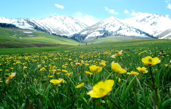
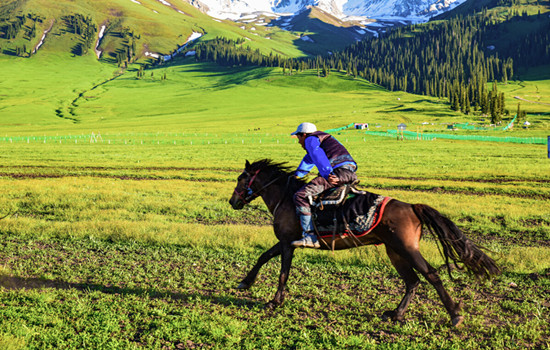
Day 11 Yili-Naraty (about 280KM)
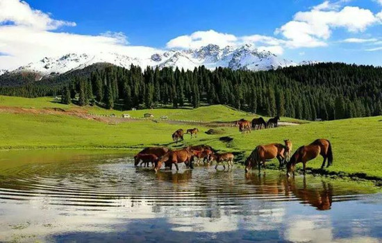
Today's attractions: Naraty
Naraty tourist scenic spot integrates grassland,valley and forest,with high vegetation coverage rate and rich wildlife resources. Because of its unique natural ecological landscape and cultural landscape,it is known as "Tianshan Green Island","green home" and "colorful grassland". The main scenic spots are Tianjie Platform,nomadic family,Tusani (meaning "beautiful valley" in Kazakh),Sendai,Wall Tower observation platform,Snow Lotus Valley and so on.
Itinerary
Enter the Naraty grassland scenic area,looking for the rich beauty of the beekeeping women. You can overlook the beauty of the whole valley grassland,but also go to the snow lotus valley and snow mountain close contact,feel the cool summer.
kindly reminder:
1.Nalati Airland Grassland is located in a mountainous area,please always be ready to add clothes.
Day 12 Naraty-Yili (about 280KM)
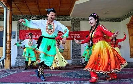
Today's attractions:
Kazanqi folk tourist area
Kazanqi Folk Tourism Area in Yili City is the only large original ecological cultural scenic spot in northern Xinjiang with Uygur ethnic customs as the main body,because it is the window of the image of Yili city,but also the true portrayal of ethnic customs,which covers the thick Uygur culture,without losing the unique customs and feelings of the Uygur ethnic group in northern Xinjiang.
For foreign tourists,Kazan is enough to meet their aspirations of "running in the city by carriage" and "feeling the ancient traditional folk culture in the modern city". Here,the original Uyghur traditional way of life is still preserved: the antique Uyghur people's residence; A poetic bridge running water; Tall and simple poplars can be seen everywhere; Mellow milk tea,exquisite pastries; Classical,traditional and lively Uyghur wedding; Wild,cheerful,passionate Macilef...
Itinerary
The characteristic Uyghur traditional architecture in Kazanqi Folk Tourism Area of Yili City is not only to experience different folk customs,but also to enjoy many special foods waiting for you!
In recent years,the Liuxing Street in Yili City has witnessed the strange cultural symbiosis phenomenon of the combination of foreign culture and local culture.
kindly reminder:
1.Today in the city can follow the tour bus to go,can also be free activities,is a little rest of a day!
Day 13 Yili-Kuitun(about 400KM)
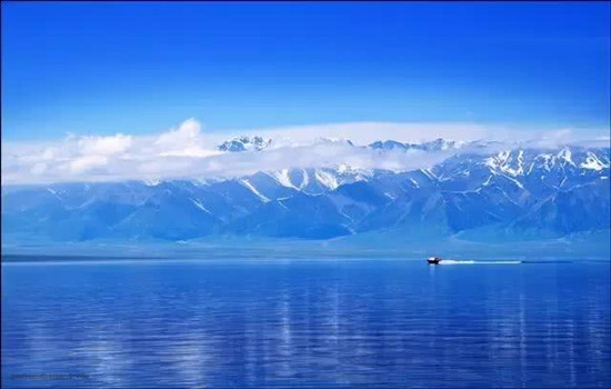
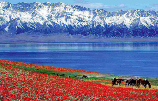
Today's attraction: SayramLake
SayramLake,known called "Net Sea",is located in the North Tianshan Mountains in Bole City,Xinjiang Province,close to Huocheng County,Yili Kazak Autonomous Prefecture. The lake is 2071 meters above sea level,30 kilometers long from east to west,25 kilometers wide from north to south,an area of 453 square kilometers,the water storage capacity of 21 billion cubic meters,the water is clear and transparent to 12 meters.
Itinerary
Through the first scene of Yili-fruit ditch,on the way you can enjoy the fruit ditch bridge built between the mountains,You can take photos and punch in the SayramLake scenic area,stop and enjoy the leisurely time. Summer cerimu Lake wild flowers in full bloom,you can sit on the ground by the lake and meditate,you can also ride on the grassland. At this moment,time can stay in the camera,can also quietly disappear in the casual laughter.
kindly reminder:
1,Guogou Bridge is the only place on the way,the bridge can not stop,can only drive slowly slowly experience the steep here;
2. SayramLake has a high altitude and the weather changes quickly. Please prepare sunscreen,wind and cold prevention equipment in advance.
3. The scenic area is located in a remote area,with high prices and accommodation conditions are limited. Please make psychological equipment in advance.
Day 14 kuitun-Burqin (about 450KM)
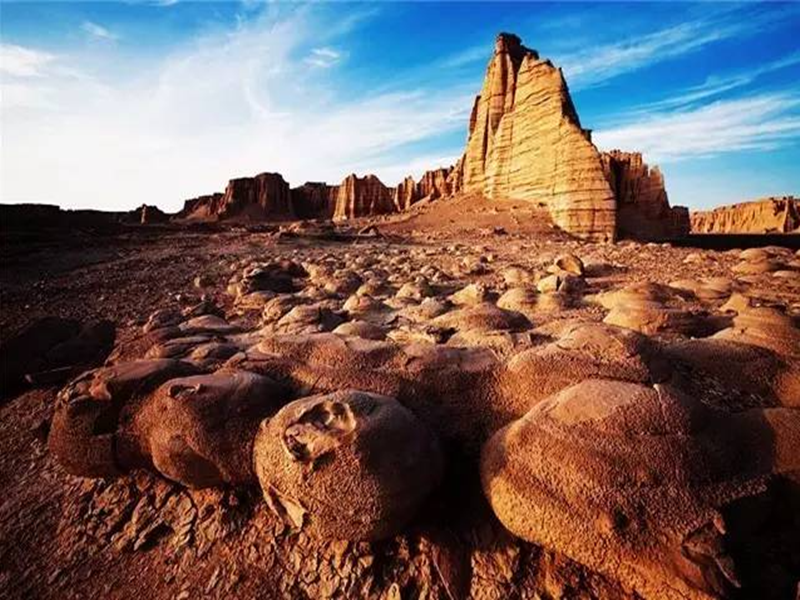
Today's attraction: Urhe Devil's City
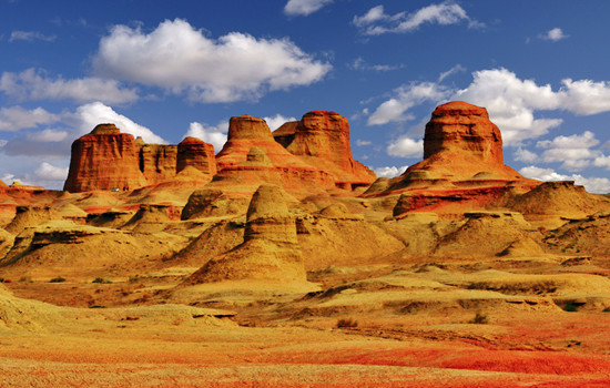
Uerhe Devil City,also known as Uerhe Wind City,100 kilometers away from Karamay City,is a unique wind erosion landform,strange shape scenery makes the local Mongols call this "SulumHak". The Uighurs called it "Shayi tank si",which means where the devil lives. In fact,here is a typical Yadan landform area,in the northwest,east and west,the length and width of about more than 5 kilometers,a radius of about 10 square kilometers,the ground is about 350 meters above sea level.
According to investigation,about one hundred million years ago in the Cretaceous,here is a huge freshwater lake,shore with lush plants,water habitat breeding ur wo,plesiosaurs,dinosaurs,junggar pterosaurus and other ancient animals,here is a aquarium gathered "heaven",then after two big crust changes,the lake became sandwiched between sandstone and mudstone land vast,geology called it "gobi platform".
Five Colors Beach
Coloful Beach is a national 4A scenic spot. It is located in a dry and windy area. Due to the varying degree of resistance to weathering between the riverbank rock formations,it forms a jagged outline. The rock formations are composed of red,earth red,light yellow and light green sandstone,mudstone and sand conglomerates. It's a typical colored hill.
Itinerary
Urhe devil city,appreciate the Yadan landform,naturally formed a variety of pictographic attractions,three points by looking,seven points by thinking.
The rock has different colors,colorful,such as colorful castles,monsters,peaks and other strange landforms,which is a typical colorful hills. When the wind rises,it will make a strange sound,adding a mysterious color.
kindly reminder:
1. Strong windy,hot in summer,has avoided the midday sun,but the climate is dry,pay attention to sunscreen and water; please prepare for sunscreen and heatstroke in advance.
2. The sunset time of the Five Colors Beach varies with the season. If there is no sunset,the weather may not be able to watch the sunset,please prepare psychologically in advance.
Day 15 Burqin-Kanas (about 180KM)
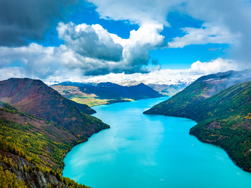
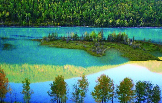
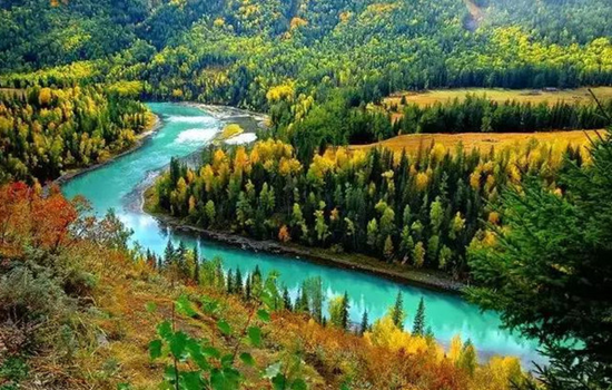
Today's scenic spot:Kanas
With the majestic scenery of the north,and the beauty of the Jiangnan landscape,in addition,there are "sea of clouds Buddha light","color lake","float wood long dike","lake monster" and other beautiful scenery,how can not be called the western regions of the beautiful scenery,fairy scenery. To the north is the snow-covered Kuitun Mountain,the towering Friendship Peak. Around the lake,the mountains,the mountains like a painted screen. Different plant communities have distinct layers and different colors.
Itinerary
By interval car into the kanas scenic area,through kanas famous three bay "Shenxian Bay,moon bay,wolong bay" to the Shenxian Bay water become sparkling,like flashing pearl necklace,then arrived at the moon bay,overlooking the like a huge footprints in crescent river,and then to wolong bay,like the sword in the Jurassic park,lying in the middle of the river
You can walk in the ancient Kanas Tuwa village,also can go to the Kanas Lake by car,in the peaceful and mysterious,beautiful fairy tale world,temporarily put down the anxiety of city life,meditation eyes,open arms to embrace the quiet and empty here.
kindly reminder:
1,there are many mountain roads,please carsickness tourists must pay attention to prepare carsickness medicine in advance;
2,To enter the Kanas scenic area,you must transfer to the regional car in the scenic area,because the interval car is a cycle,there are many stops along the way,in order to facilitate sightseeing,it is strongly recommended to carry the items needed that night,light to enter the scenic area,large luggage temporarily on their own tourist car;
3, In order to facilitate you to have more tour time in the scenic area,so regardless of the cost of special accommodation in the scenic spot,but due to the poor local infrastructure and environmental requirements,the accommodation conditions in the scenic area are poor,please make psychological preparation in advance;
4,There are still many local residents living in the scenic area,please do not tease cats and dogs,stay away from animals. When communicating with the local residents,please respect the local customs and habits.
5,According to the regulations of the scenic spot,hiking is not allowed,and smoking is not allowed. Please cooperate。
Day 16 Kanas-Hemu(about 100KM)
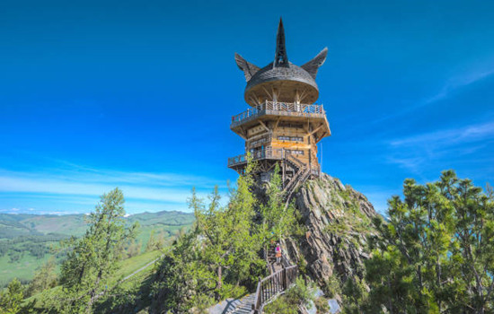
Today's scenic spot: a fish viewing platform
The fish Pavilion is located on the top of a mountain near the lake,700 meters relative to the lake. It takes about one and a half hours to climb the artificial stone ladder from the lake. After the view of the fish pavilion,there is a dirt road to reach the top of the mountain,but there is no feeling. Part of the fish pavilion hangs in the middle of the summit,but this half is the most critical position to look at Kanas Lake.
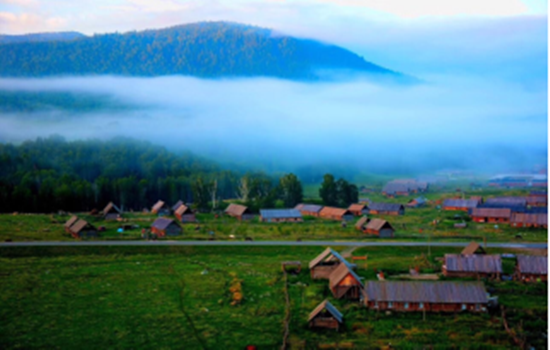
Hemu
Hemu River flows from northeast to southwest,natural and primitive mountain scenery,primitive village and the prairie harmonious and natural integration. When we come to Hemu Village,the first thing to enter our view is the small cabins and groups of herds,together with snow peaks,forests,grassland,and constitute a unique natural and cultural landscape with blue sky and white clouds.
Its significance is that these cabins have become the symbol of the Tuva people. Most of the cabins are buried in the soil to resist the cold of the snow for nearly half a year,which is particularly primitive and simple,and has the traditional characteristics of nomadic people. The roof is generally nailed with wood adult type canopy,the room body with a diameter of 30 centimeters of 30 or a single layer of log pile,both warm and moisture-proof.
On the hillside around Hemu Village,you can overlook the panoramic view of Hemu Village and Hemu River,view the sunrise,snow peaks and trickle streams,and visit the Tuwa family. It is the best place to shoot the sunrise,morning fog,wooden house and Hemu River.
Itinerary
Go to the transfer center to take the interval bus on the fish platform. On the view of the fish platform,go up the mountain to see the lake,down the mountain to see the scenery,enjoy the highlight of the Kanas central scenic spot!
First find the home stay,put down your luggage,you can go to the viewing platform to overlook the whole village. The fastest return time is about 2 hours. You can also enjoy free activities in the river and birch forest to enjoy the lazy leisure time of the wood.
kindly reminder:
1、 On the day of the whole mountain road,carsickness tourists must pay attention to prepare medicine in advance
2、 The scenery along the way to the scenic area is infinitely good. If you need to get off to take photos and punch in,please communicate with the master in advance,and find a safe area to stop before getting off. When you need to cross the road,please pay attention to the passing vehicles and pay attention to the safety on the road.
3、 Due to the remote location of Hemu Village,the prices in the scenic area will be relatively high than those in the city. Please prepare the required items in advance.
4、Hemu Village is mainly wooden homestay or wooden villa,can choose to stay limited,need to have psychological preparation in advance.
Day 17 Hemu-Beitun(about 260KM)
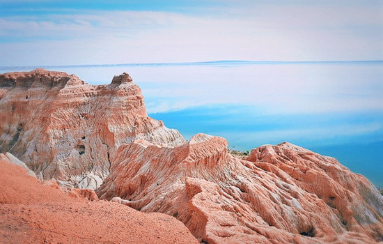
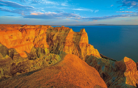
Today's attractions: Sea devil City
The composition of the sand shale of the Cretaceous period,more than 100 million years ago,shows different colors due to the difference in different rock layers. The iron-bearing rock is red,the iron-bearing rishi is purple,the coal layer is blue after weathering,and the muddy rock is transformed into yellow strata to create the sea Devil City.
Itinerary
Start from Hemu scenic spot and go all the way to Fuhai County. Arrive in Fuhai Sea Devil City,here there are seaside scenery,and canyon charm. This very rare Yadan landform is north-south,stretching for more than ten miles,and the slope is a bucket circle.
kindly reminder:
1.The scenic area is large and far,plaese choose take transfer car.
2. Please take comfortable shoes.
Day 18 Beitun- Cocotosea (about 230KM)
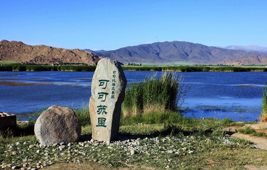
Today's attractions:Coco suri
It is one of the main scenic spots of Keketuohai National Geopark,23 kilometers away from Fuyun County,Hoh Xil Lake,also known as Wild Duck Lake,with an area of 2677 mu,an average water depth of 2 meters,and more than 20 floating islands formed by staggered reeds in the lake,rich in aquatic plants.
Keketuohai Scenic Area
Keketuohai Scenic Spot (namely Ertyses Grand Canyon Scenic Spot) is the source of the Ertyses River,a famous river in northern Xinjiang. The scenic spot is about 20 kilometers long,among which there are more than a dozen scenic spots such as birch forest,Shuiditch,Shenzhong Mountain,and hot spring,all along the Ertyses River. There are interval cars in the scenic area,which is a round-trip ticket from the scenic area gate to Shenzhong Mountain (17 kilometers one way). Intercars operate in a way similar to a bus,with a few stops in the middle,tourists get off to visit the surrounding scenic spots and then wait for the next car. There is still 6.5 kilometers away from the hot spring in the deep canyon. You need to go on foot. If you do not have enough physical strength,you can also take the patrol car in the scenic area.
In the gate of the scenic area to Shenzhong Mountain a section of the more key scenic spots are birch forest,water mill ditch,Hongye ditch and Shenzhong Mountain. There are also a lot of strange peaks and rocks along the road,in the middle of the Ertysh River is clear and magnificent,you can have a good play.
Itinerary
Starting from the hotel,along the G216 national Road to Fuyun County,the Gobi scenery is also an indispensable beauty along the way.
Arrive in Cocosuri Scenic area,punch in and take photos,and go to Keketuohai Town.
Arrive at Cocato Sea Scenic spot. It takes about 10-15 minutes from the parking lot all the way to the ticket office,and the interval car takes about an hour. Get off at the end of the interval car and return to the original way. There is a battery car beside the bridge below Shenzhong Mountain,and you can walk another 3 kilometers into the canyon. This fee is not included in the interval ticket of the scenic area,so you need to buy a ticket here alone. Do not take the battery car can play in the river,or next to a mountain mountain play. Pay attention to safety along the way. After the original road back to the parking lot to take the interval car to the entrance of the scenic spot.
kindly reminder:
1. Large temperature difference between morning and evening,Take long-sleeved clothes with you. Suitable for light hiking,to wear comfortable shoes;
Day 19 Cocotosea-Qitai(about 330KM)
Today's scenic spot: Kambark
Kambrak is a Kazakh word meaning source of holy water. She gathers the spirit of the Tianshan Mountains,and integrates many beautiful legends. Here,the distant mountains near the water,the forest sea snow peak blend,the green wave flower sea like the tide,a holy natural scenery. The beautiful Jiangbulak attracts the attention of many visitors with its beautiful and charming,poetic and dream-like flower Haizi,quiet and quiet Heilaoga,the world's largest Tianshan Mountain slope,and the idyllic scenery of fields and field
Itinerary
Across the G216 National Road,there are many small wild animals along the way to attract people to stop. Lunch in real time.
In addition to the thousands of acres of wheat fields spread over the hills as if you were in a European town,there is also the magical Tianshan slope,which is a strange phenomenon of riding automatic walking on the downhill slope and arduously climbing the slope without force. There is also the most famous symbol - "knife ridge". Between the extended snow mountains,there is a high rise of the snow mountain,which is in a long strip,standing like a knife blade,so the local herdsmen call it "knife picking ridge".
kindly reminder
1,Jiangbulak scenic spot is at the top of the mountain,before entering the scenic spot,look at the weather changes,ready to add the coat around you at any time;
2,if you want to ride in the scenic area,please speak in advance of the price and time before riding,please do not walk casually behind the horse to avoid causing safety problems.
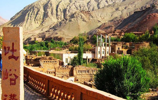
Day 20 Qitai-Turpan (about 330KM)
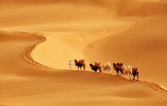
Today's scenic spot: Kumutag Desert
Kumtag Desert,covering an area of 2,500 square kilometers,is located at the southern end of Shanshan Old Town,Xinjiang Province,which is one of the few deserts in the world that has close contact with cities. It is characterized by complete sand landforms,clear outline and distinct layers of sand dunes. Kumtag means "sand mountain" in Uyghur language,and Kumtag Desert is "desert with sand mountain".
Library wood tower desert mainly because from tianshan seventeen well tuyere southwest wind and daban city tuyere southeast wind,along the changfeng journey,with a lot of sand,finally meet in library wood tower area collision and deposition,south of cook tag mountain also contributed to two directions of wind weakening and sand deposition,forming "sand mountain desert" the unique landscape. Therefore,the Kumtag Desert has become a scenic spot integrating scientific research,investigation,exploration,sand sports,sand therapy and health care,and desert sightseeing. The temperature difference between day and night in the sand mountain is large. In midsummer,the surface sand temperature is 70℃,and the highest is 82.3℃. The eggs can be buried in the sand.
Tuyugou Maza Village
Maza Village belongs to the climate zone south of the Flaming Mountain. It is a historical and cultural ancient village integrating human landscape and natural landscape,Buddhist culture and Western culture. With a history of more than 2,600 years,Mazha Village is a typical representative of the village pattern under the Islamic cultural background in eastern Xinjiang,showing the traditional Uygur style of "ancient villages,ancient houses,ancient alleys and ancient trees". There is Tuyugou Grottoes,a national key cultural relic protection unit,in the north of Mazha Village,and Huojiamu Mazha in the west. A large number of traditional houses built with raw soil are preserved in the village,which is a model of raw soil architecture in Xinjiang and is known as "the first soil village in China".
Itinerary
The Kumtag Desert scenic area in Shanshan County. On the golden sand mountain,you can see the long yellow sand and rolling sand ridge,connected with the sky,giving people a vast,magnificent,solemn and profound feeling. Standing at the junction of the oasis and the desert,watching the square scenery,the strange scenery in front of the amazing: one side is the vast,vigorous,boundless desert ocean; the other side is the lush,beautiful and charming oasis green wild. This is the outstanding nature of nature,there is no transition between yellow and green,but the two colors form a sharp contrast,just like the painter's color plate,yellow and green,strong contrast and harmonious unity,it is amazing.
The Maza Village in Tuyugou is surrounded by mountains and built by oasis. The Subexi River runs through the village,connecting six clusters. Village cultivated land is near the water distribution,residential houses and cultivated land depend on each other,living near the water. T
kindly reminder:
1,Turpan perennial drought and less rain,pay attention to small drink water,heat and sun protection
2,enter the desert scenic area to pay attention to your belongings,small items must be collected in advance,similar to bracelets,necklaces,rings and other valuable jewelry fell into the sand,it is difficult to find back.
3,If you want to take textured photos in the desert,you can wear white,black,red,and you can take several more sets of clothes for a change. Men can wear black coats and take cool pictures.
4,If you want to make some videos like the ethereal air,then the red skirts and scarves must be ready. Silk scarf is the best god in the desert collocation. The silk scarf at the gate of the scenic spot is 35 yuan each. Choose the white or red silk scarf.
Day 21 Turpan-Urmuqi (about 280KM)
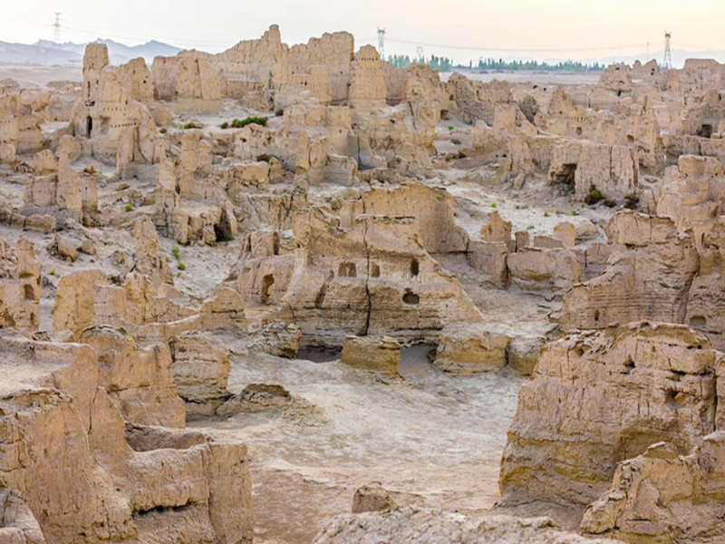
Today's attractions: Jiaohe Ancient City
Jiaohe city site,located in turpan city about 13 kilometers west of Yar township,the western suburb of Turpan city 10 kilometers eraizi ditch two rivers intersection 30 meters high loess platform,about 1650 meters long,both ends narrow,the widest about 300 meters,is a willow leaf shaped peninsula. It is the capital of the former state of the former state of the ancient Western Regions,and is the political,economic,military and cultural center of the country. The drought and little rain in Turpan made the old city very complete. The buildings are all made of rammed earth plates,and the shape and layout are similar to that of Chang'an City in the Tang Dynasty. In the city,streets,offices,temples,stupas,streets,workshops,dwellings,performance fields,Tibetan trenches,temples and temples can also be found. The temple covers an area of 5,000 square meters,with a large water well. The pagoda group has 101 stupas. Looking down from the air,the Jiaohe old city looks like a big willow leaf.
Karez Well
Karez Well is a kind of underground water conservancy project created in the long historical development of the working people in the arid land. The Karez Well drew out the groundwater,turning the desert into an oasis,called the "well canal" in ancient times. The main working principle of Karez Well is that people use a large amount of rainwater,glaciers and snow melt water seeping into the ground in spring and summer by using the natural slope of the mountain to draw out the surface for irrigation,so as to meet the demand of production and living water in desert areas. Karez Well in different regions have different regional characteristics in specific structure,but generally speaking,a complete Karez Well system includes four main components: shaft,culvert (underground channel),open channel (ground channel) and fault occurrence (small reservoir). Under this principle,the flow of the arez is stable and the irrigation of well water can be guaranteed.
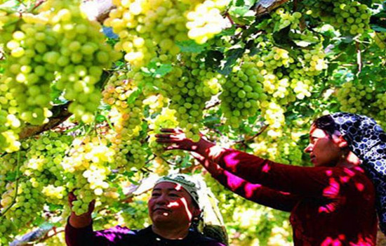
Grape Valley
The scenic grape Valley is famous for its high-quality grapes. Here by the mountain next to the water,quiet,elegant,scenery,several grape corridor deep,quiet,some tourists walk under the grape frame,look up to enjoy the taste of pearl-like grapes,some visitors sit under the grape frame taste fresh grapes. The three bright red characters on the stone at the end of the long corridor are particularly eye-catching,and visitors rush to take photos here.
Itinerary
he world's largest and most ancient,the best preserved earth building city,is also the most complete preserved two thousand years of urban ruins,the Tang Dynasty's highest military and political institutions in the western region of Anxi capital protection Office was first located in Jiaohe old City. Walking in the city,there is a feeling of crossing thousands of years and dreaming back to the Tang Dynasty.
With a history of more than two thousand years,the Karez Well,as the source of life for the Turpan people,is an indispensable scenic spot on this trip!
Although there is no fire in the Mountain of Fire,everywhere you reach will feel like a furnace. Grape Valley is a rare summer place in Turpan in the middle of summer
kindly reminder:
1. Turpan is dry all the year round and has little rain. Pay attention to sip water to prevent sunstroke and sun protection;
2. Jiaohe Old City is a cultural relic site,please do not take photos on the trestle or climb to the earth wall,pay attention to the protection of cultural relics!

Day 22 Urumqi-Your city
Arrange the flight / station according to the flight / train information,end the deep journey of northern Xinjiang,return to the warm home! Welcome to visit Xinjiang again!
The trip time node is for reference only,subject to the actual participants