 简体中文
简体中文 English
 繁体中文
繁体中文

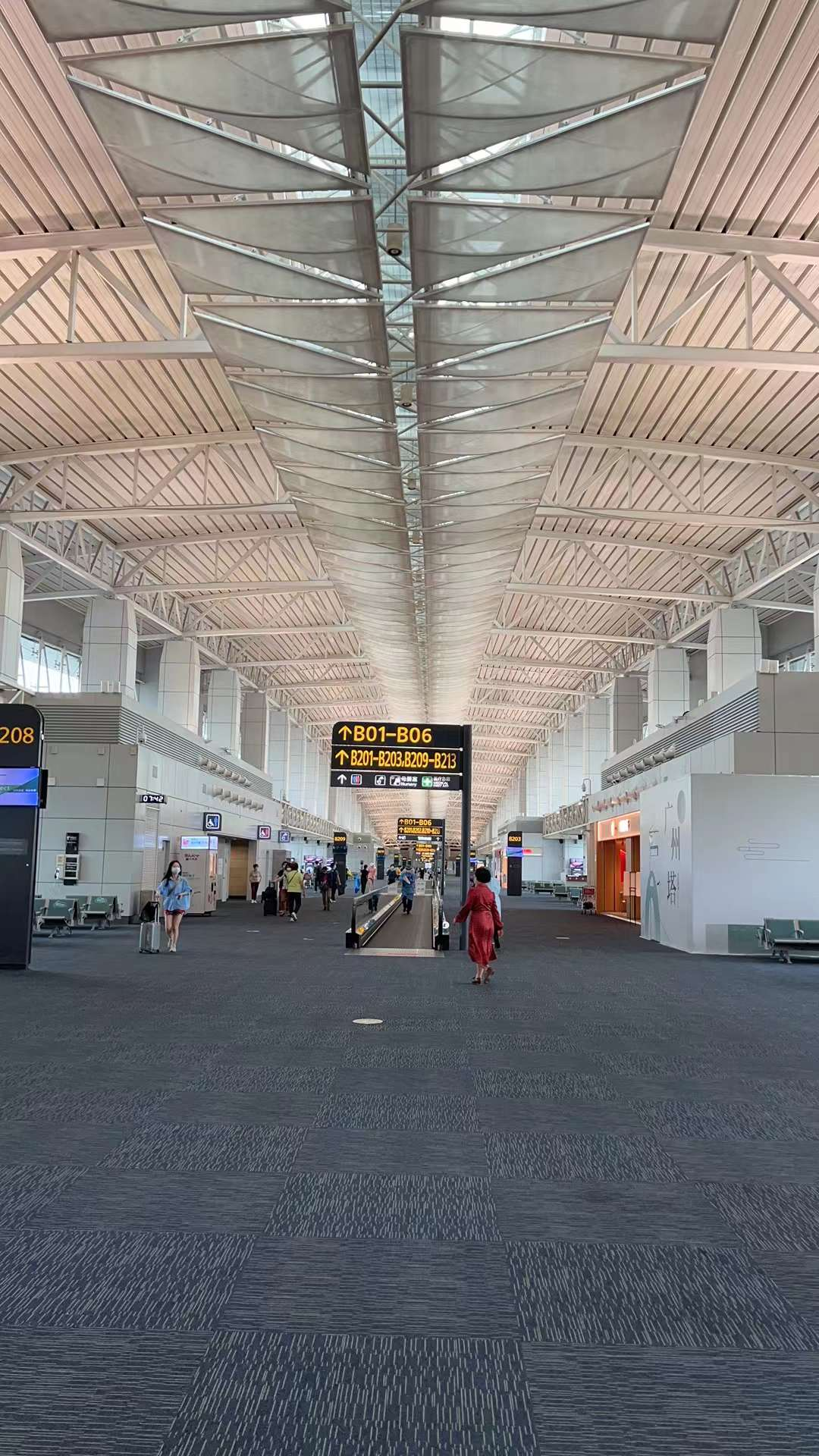
D1: This is a spontaneous trip! I didn't even plan to travel this year due to the current strangeness. Lao Zhu told me about the itinerary: after 5 seconds, it would be much easier if I didn't lead the team. I caught the last airport bus from the South City Terminal yesterday afternoon and stayed overnight at the Airport Hotel. Before boarding, I also repeated the aforementioned "quartet". At the moment when the plane accelerated, for some unknown reason, the China Eastern Airlines MU5735 plane flew at a speed of 800 kilometers at an altitude of 10000 meters. For some unknown reason, after passing through Jiuquan but not reaching Hami, it would head north and almost reach the Mongolian border before flying west towards Urumqi. The magnificent and dazzling view of 10000 meters of blue sky and white clouds is calling (0991) 752 1760 in the employee passage to the staff, waiting to retrieve it! Lunch was held at the "Loulan Secret Roast" near the airport, and the first time I had Yangtou Wusu Beer was considered a representative of beer here. Afterwards, I stayed at the "Jin Gang International Hotel" in Baoneng City, Xinjiang, which is a newly developed place. Dinner was also hosted by a friend of local friend Guo Hua at "Xinjiang Cuisine (Nanhu Branch)". I really broadened my horizons and ate Xinjiang cuisine that I didn't even know before. Tomorrow I have to drive, so I didn't drink alcohol. I just drank a type of "Royal Kavas" (Russian Royal Honey), which is said to be a drink made with honey. I describe the taste as: the feeling of washing a honey jar with water!

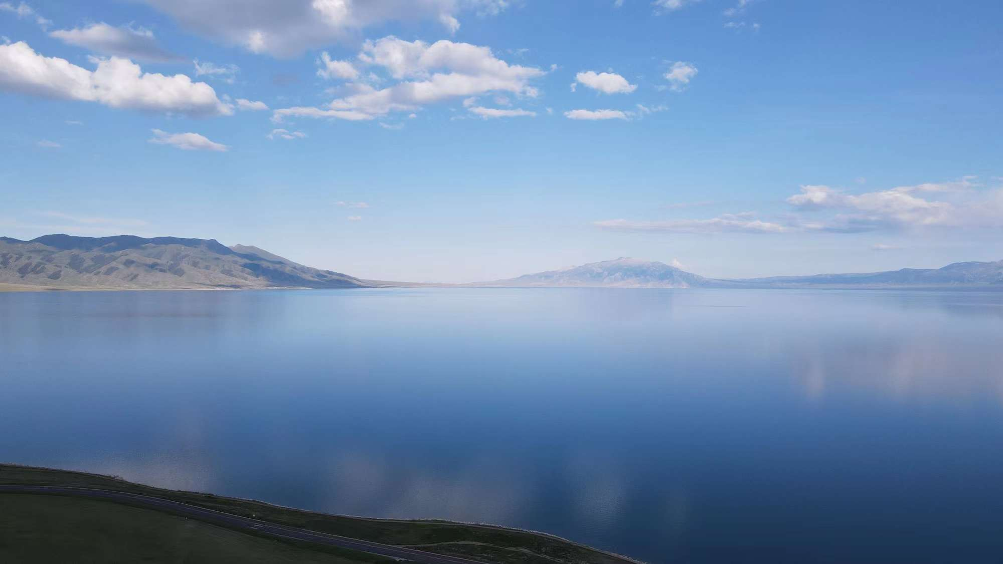
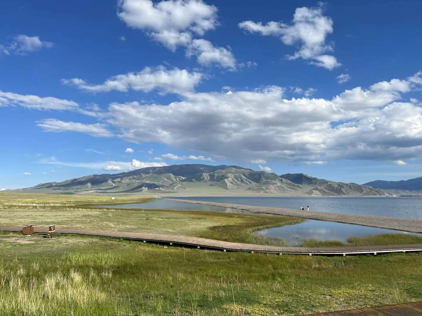
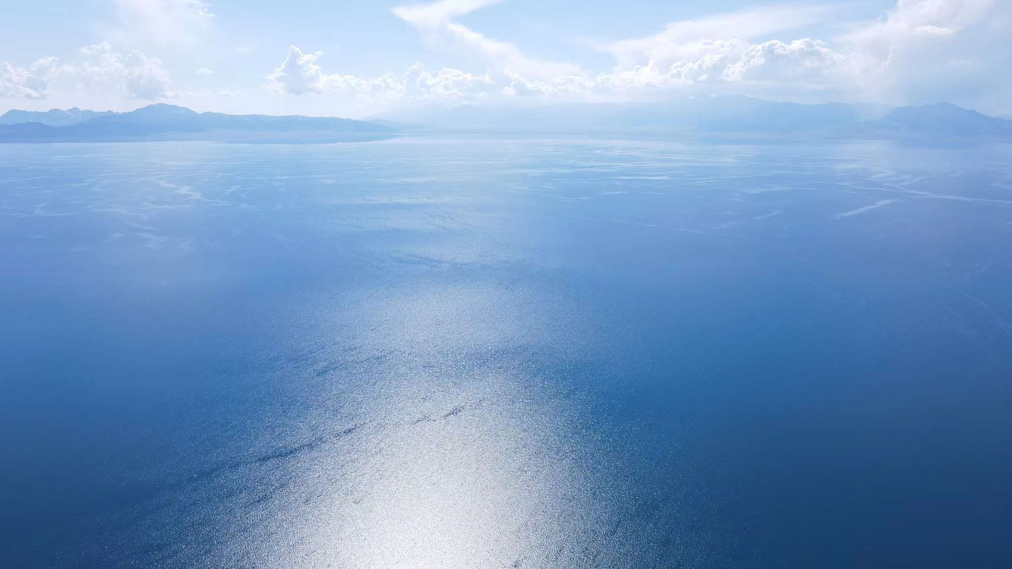
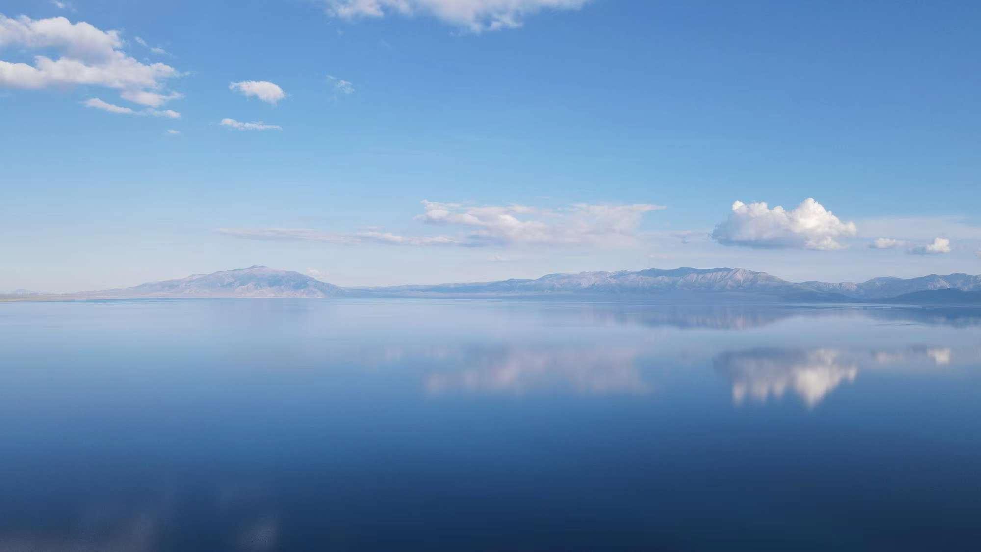
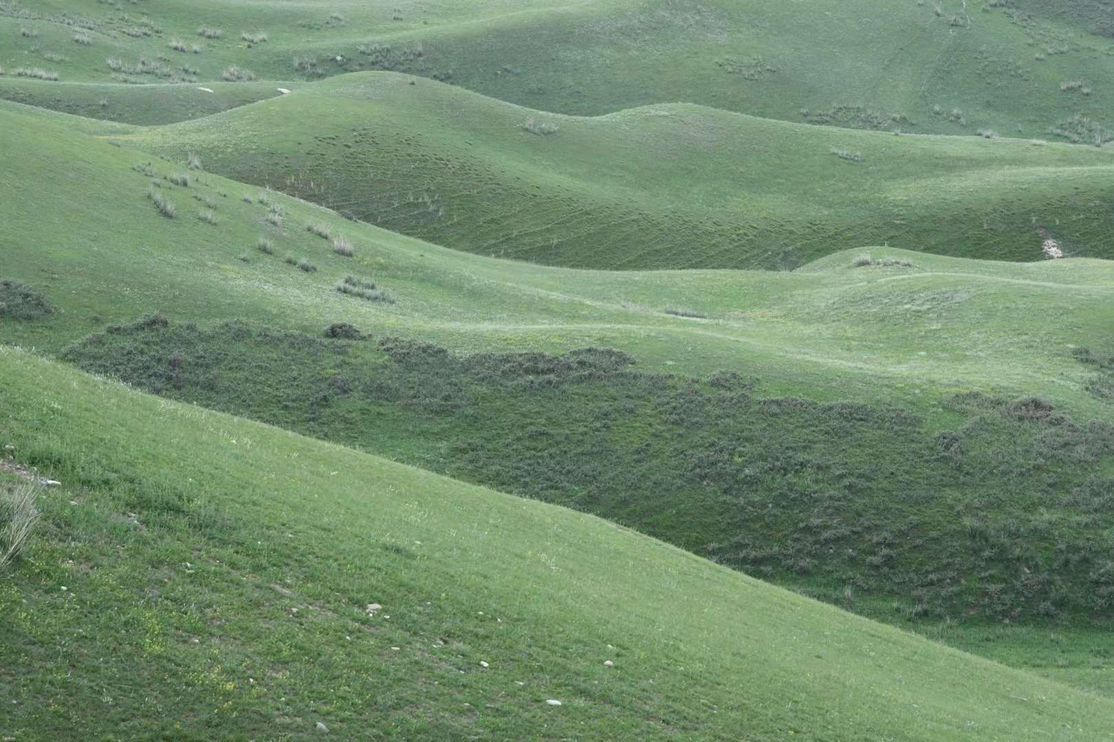
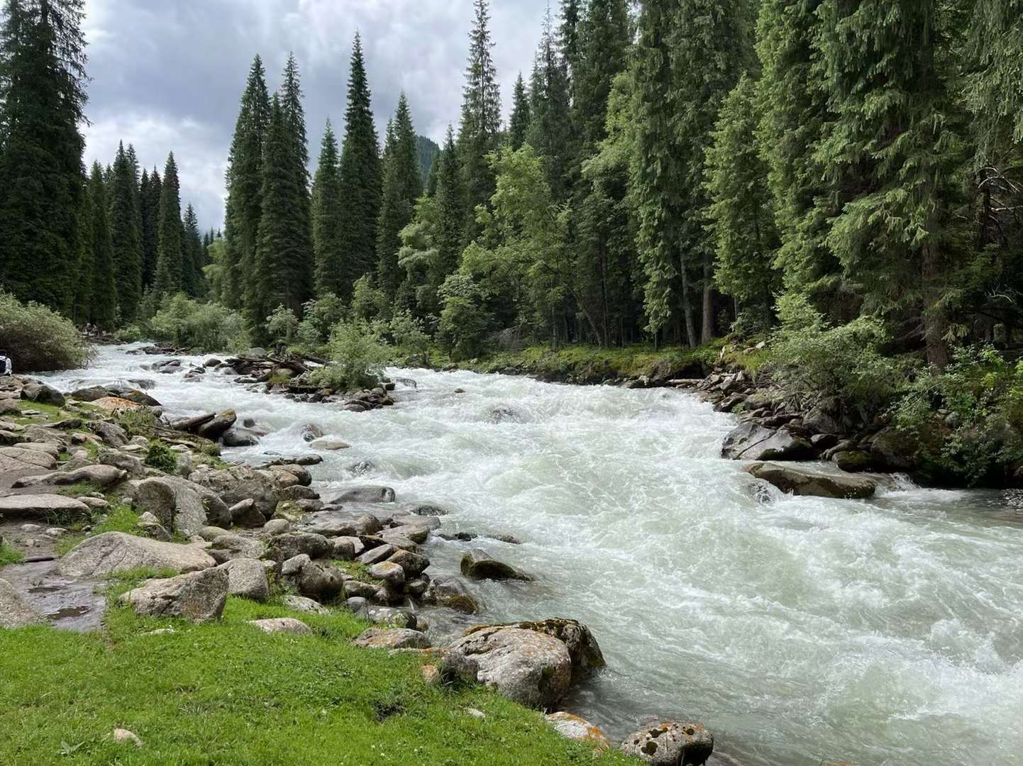
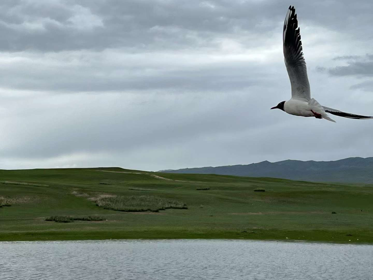
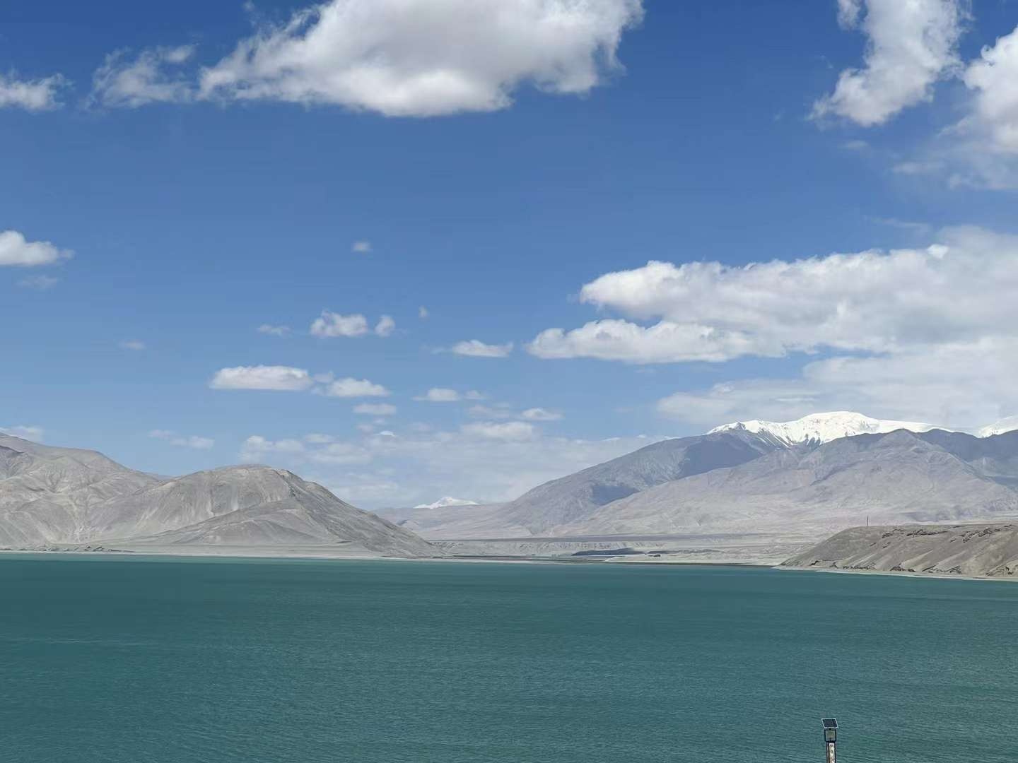
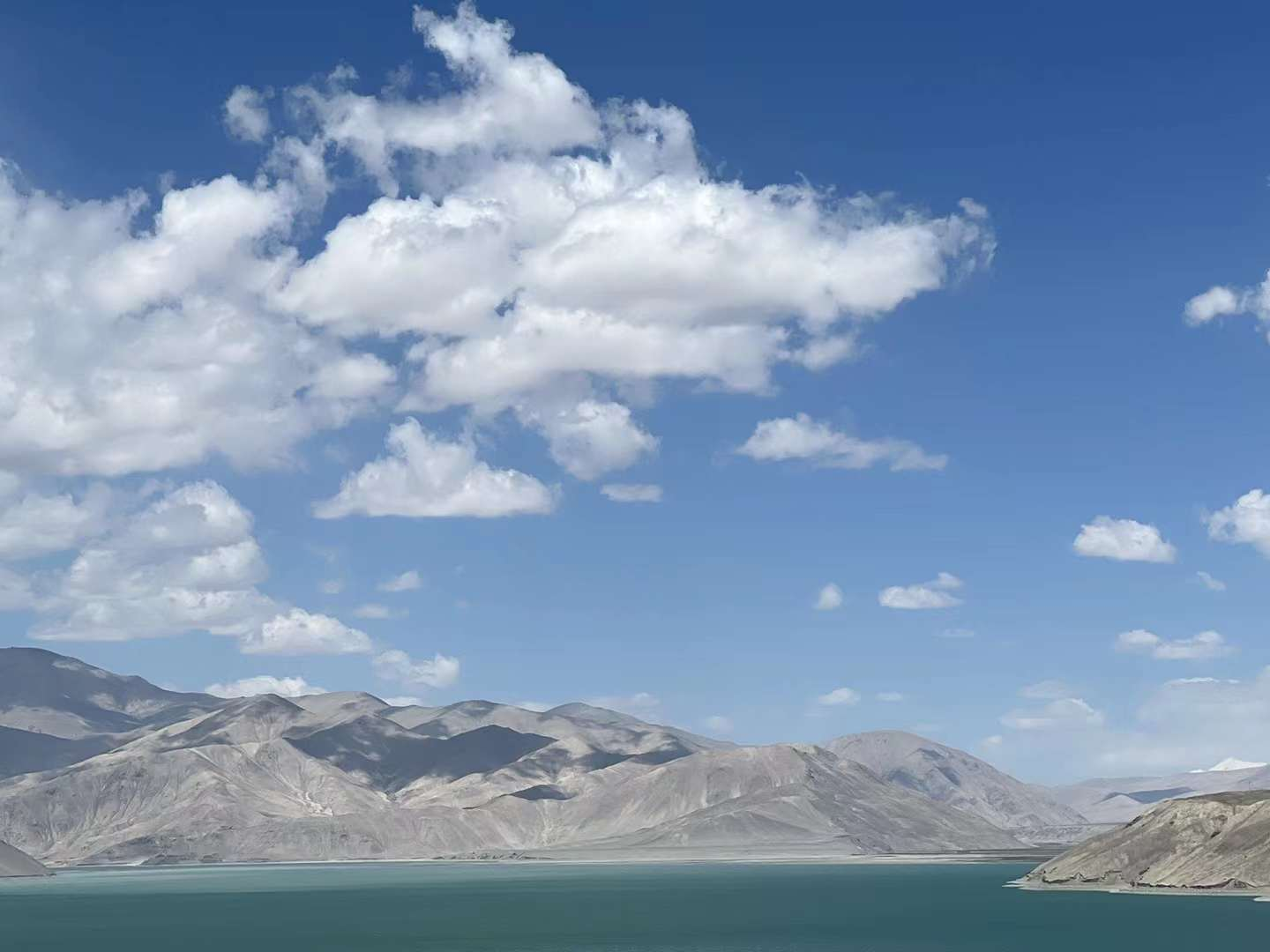
D2: Departing from Urumqi around 8:45 today, heading straight to Sailimu Lake. Arrive at the tourist center around 5 pm and have undergone nucleic acid testing before entering the scenic area. East Gate, Four Beauty RV Campsite, Pointing Platform. I stayed a few times. From the perspective of God, it is indeed different! Finally, arrive at the accommodation cabin campsite. The sunset is covered by clouds, which is not ideal. It's too cold, hurry down. I had dinner with the "high white salmon" imported from Russia and farmed in a cage in Lake Selim! The sky is full of stars, but unfortunately there is no time to shoot!
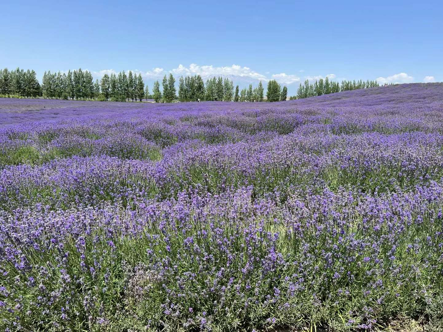
D3: It was too late to shoot the starry sky last night, and I only fell asleep before 3am. I didn't watch the sunrise in the morning, but I feel it's worth it. After breakfast, I played by the lake for a while along the way. The Sailimu Lake Tunnel does not allow passage, so it is better to detour the old road and head towards Yining City, where you can enjoy the Guozigou Bridge nearby. In 2017, I walked over a bridge and couldn't park to watch. Visit Princess Jieyou Lavender Farm. Lunch at the nearby "Meilin Farmhouse" to eat Hui people's home cooked dishes. Afterwards, I went to Yining City and visited Russian style houses and watched ethnic songs and dances in the Kazanqi Folk Culture Tourism Area. Eating century old handmade ice cream from Ili. Tour guide Guli gave us a brief explanation of customs in awkward Mandarin. Originally, there were four major monsters in Ili: no fruit in Guozigou, no Han people in Hanren Street, no flowers in Huacheng, and no bridge in Xiqiao.
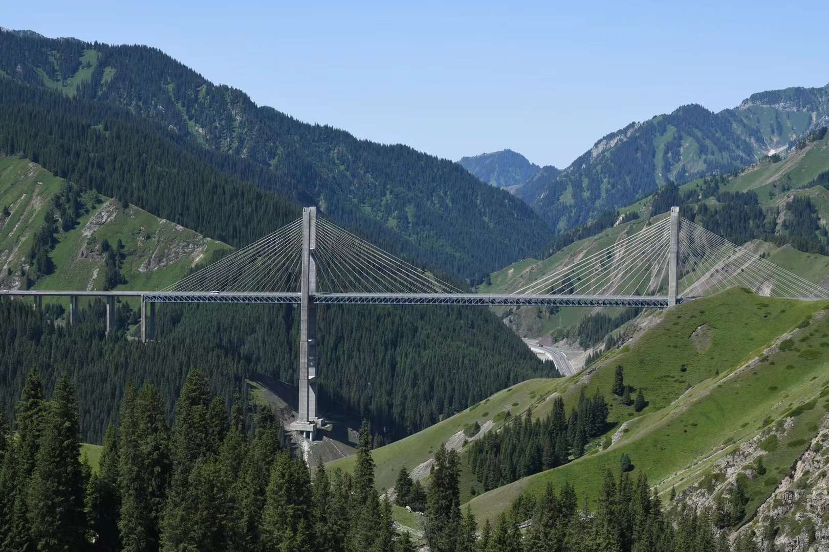

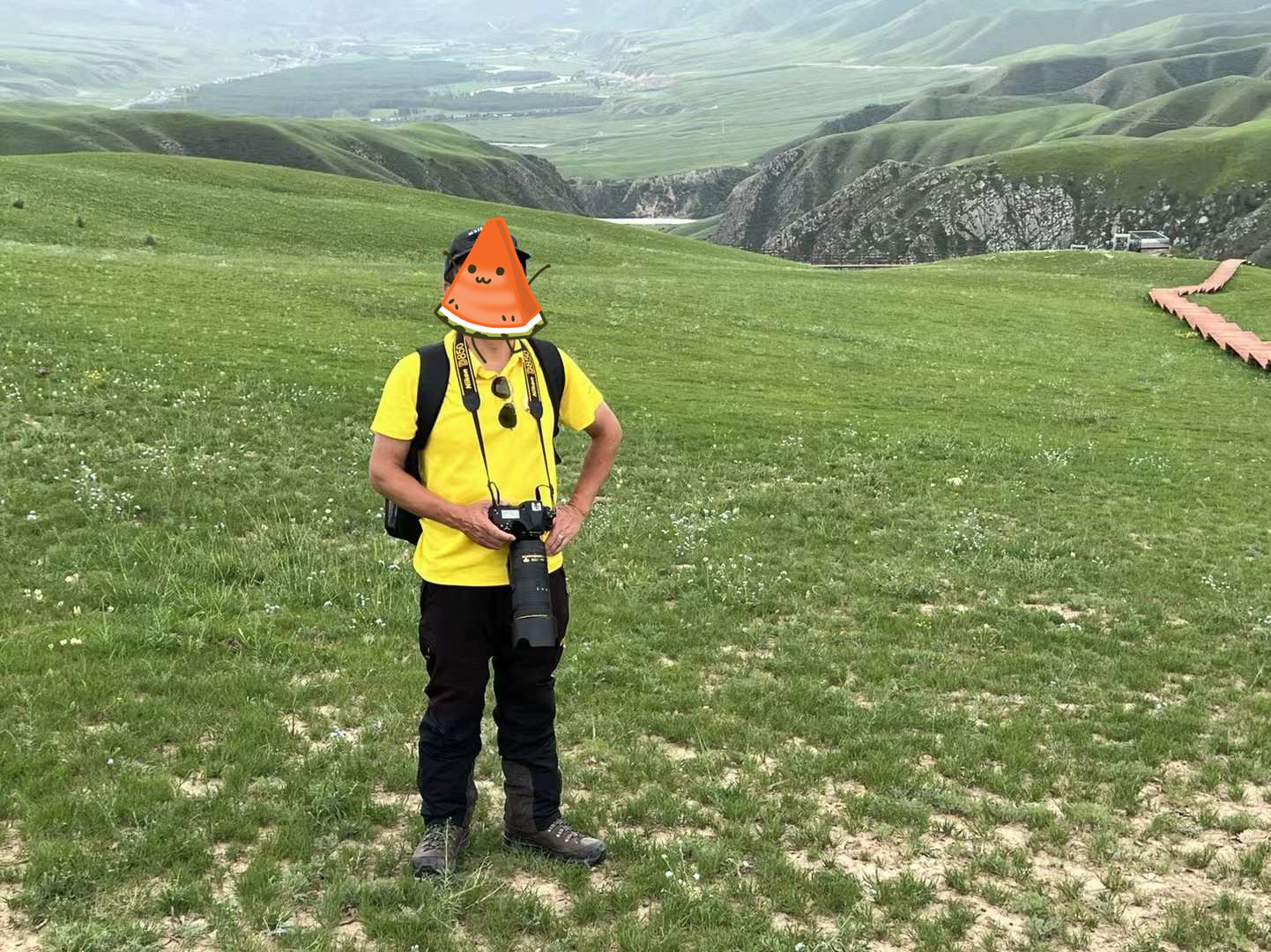
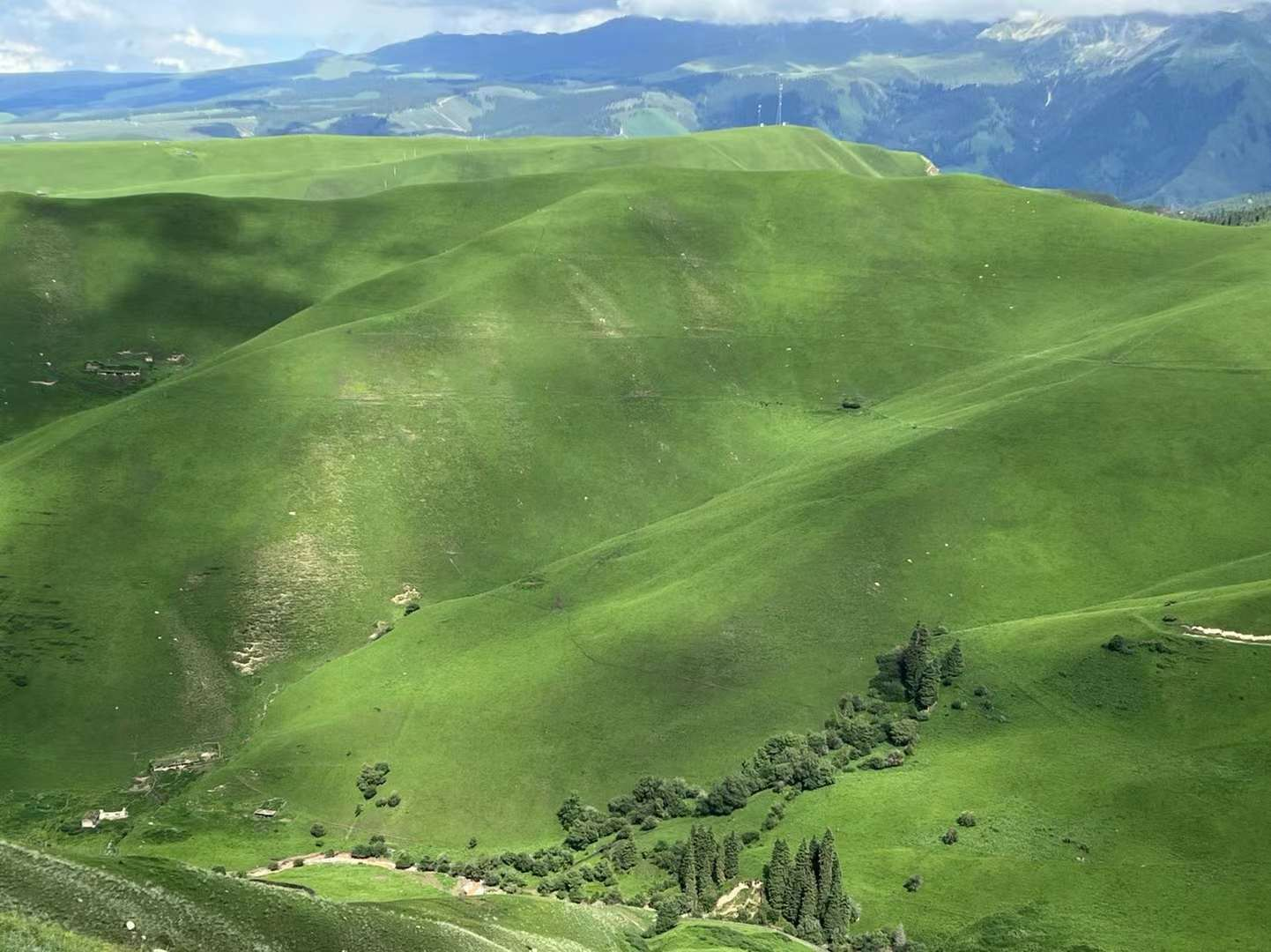
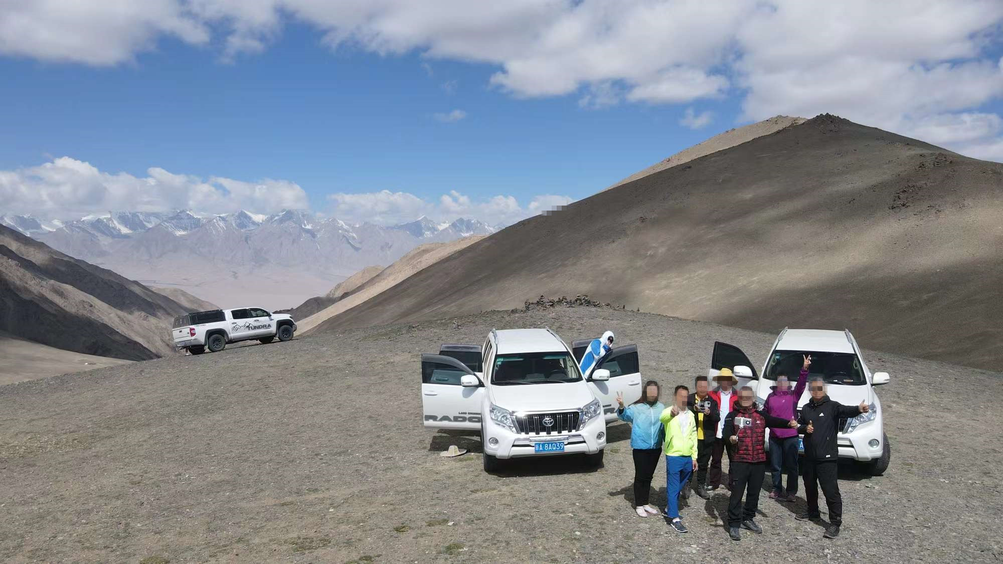
D4: Today's itinerary was relatively easy: walk from Yining to Karajun Scenic Area, visit several attractions in Crocodile Bay, and stay at the "Kurdai Folk Culture Park" within the scenic area. Most of the way was on the highway, and it went relatively smoothly. Added water and snacks in Tex Bagua City. At a restaurant outside the city that is said to be closed to the public and sometimes serves government officials for lunch: braised steak is more delicious, with fried peanuts, fermented black beans, scallions. At the entrance of the Karajun Scenic Area, each person only took one night and other items to light up. I want to take photos of the starry sky, fly drones, and flip the photos, so I'm not at ease at all. Fortunately, Mr. and Mrs. Zhu and Dr. Li helped me with some things. Today, the dark clouds are thick and there is not much sustained good sunshine. So, the scenery of the famous Karajun grassland is not very pleasing to the eye. In Crocodile Bay, it's okay. You can still fly drones, and when you reach the iconic scenic spot "Human Grassland", the light is even darker, and it even starts to rain! Take out your down jacket and put it on immediately, protect your camera! Hurry up and take the scenic bus down. In fact, this "Kuoksu Grand Canyon" (which is actually a World Heritage and AAAAA scenic area, I don't even know) reminds me of the "Colorado Grand Canyon". The terrain and topography are a bit similar, except that the Colorado Grand Canyon is larger, wider, and deeper. It just rained heavily, hoping to see the Milky Way in the early morning.

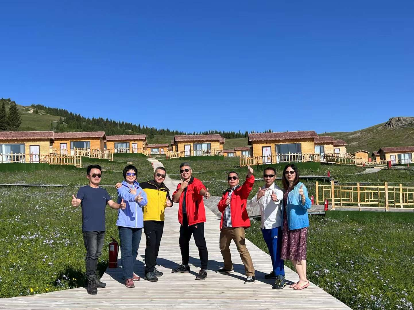
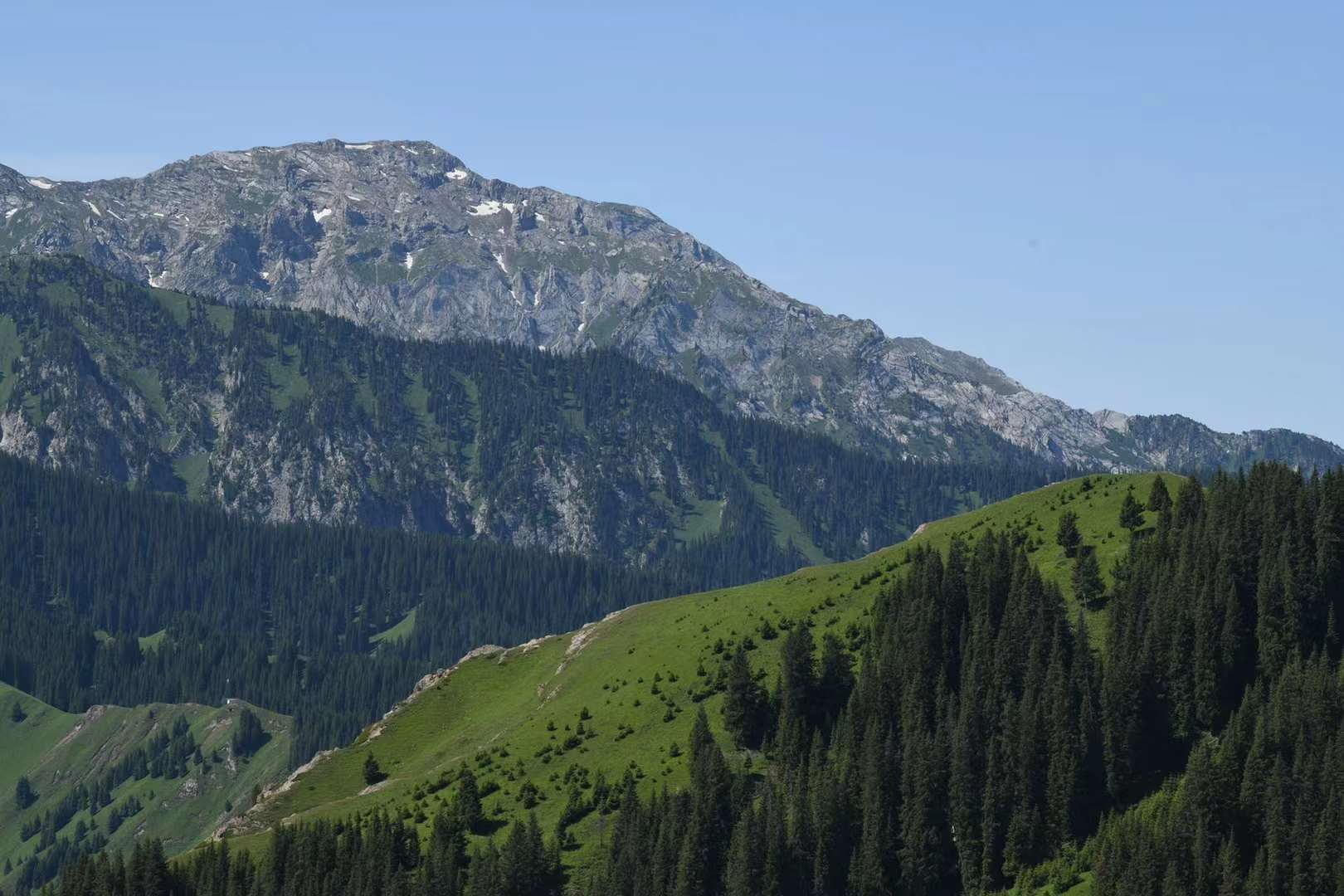
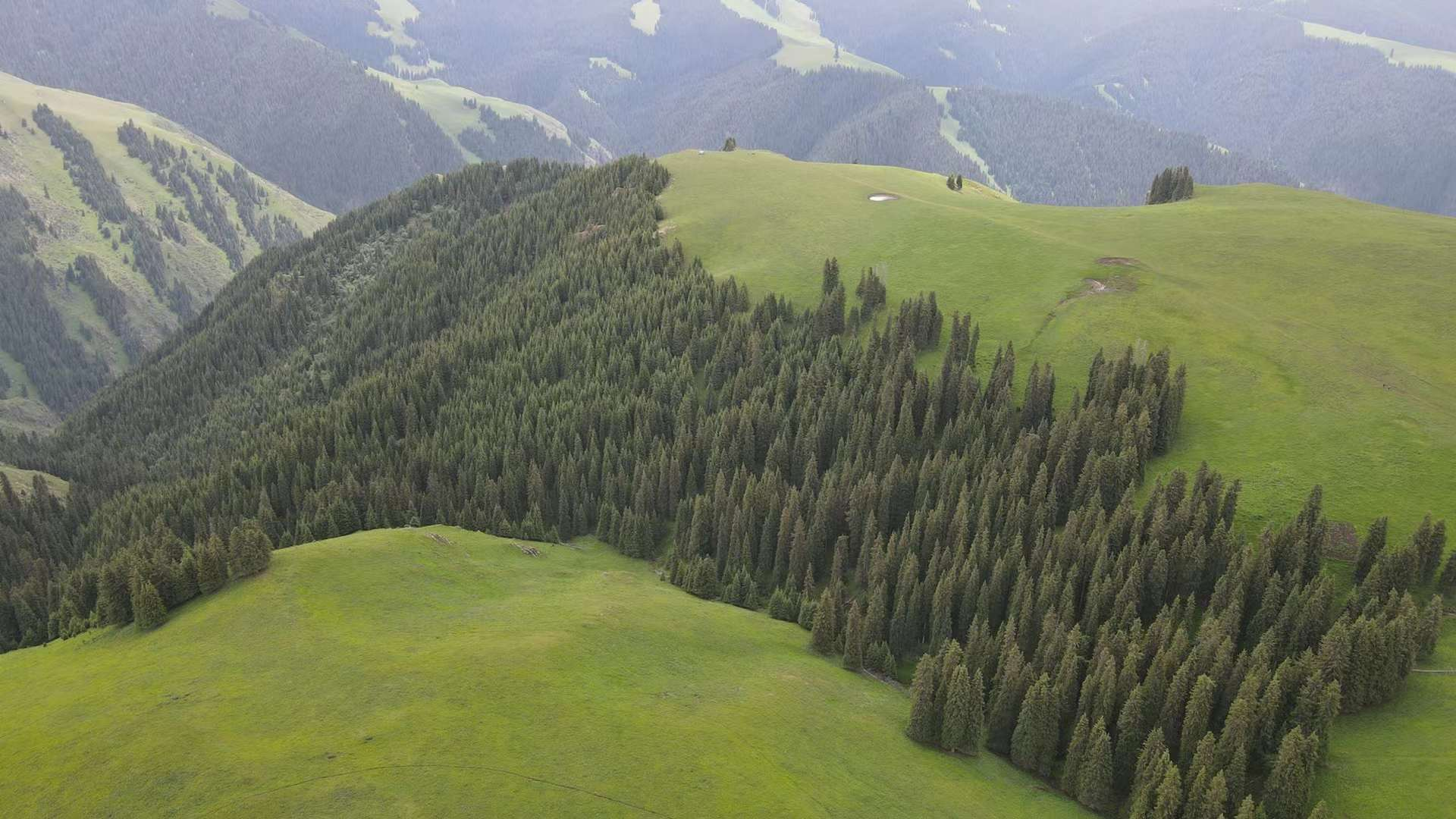
D5: It rained occasionally last night. Although it stopped in the early morning, white clouds filled the sky and the starry sky couldn't be captured. After breakfast, take the scenic bus to the cableway station and head up to visit the Flower Terrace and Falcon Terrace. In fact, both of these attractions are connected on the mountaintop, but the area is too large and divided into two. Flowers, grasslands, and cedar trees make up a pleasing picture. We, who are particularly playful, never have a moment to idle, showcasing our skills with long guns and short cannons. The "God's perspective" of drones looks good: different angles present various beautiful images! After going down the mountain, I had a meal before heading towards Qiongkushitai Village! That mountain road is even more winding than Mount Lu, with only 734 uphill roads. I estimate there are nearly a thousand people here who have climbed three mountains in a row and finally entered a valley to reach their destination! It's raining non-stop, I hope it stops raining tomorrow!
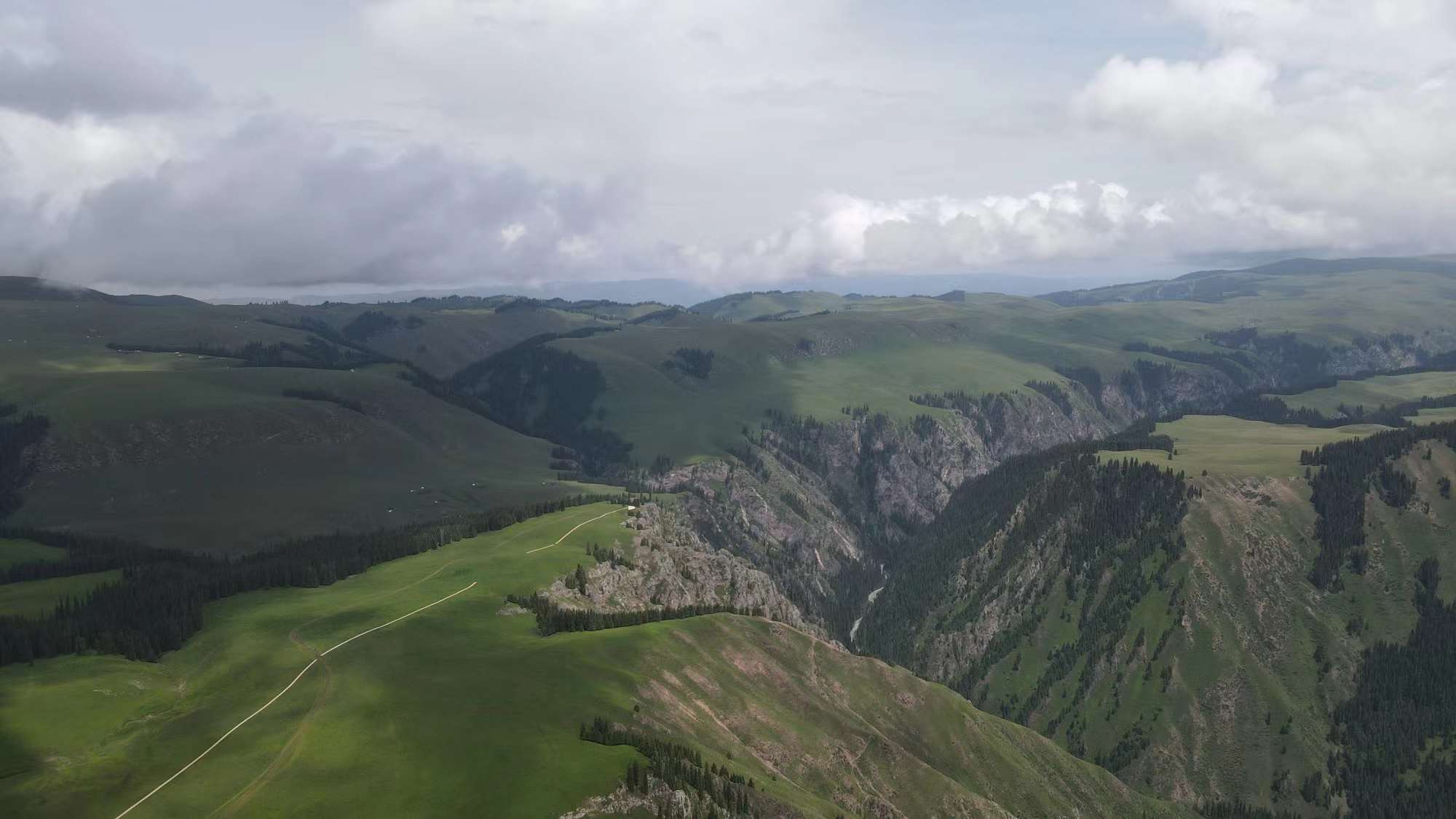
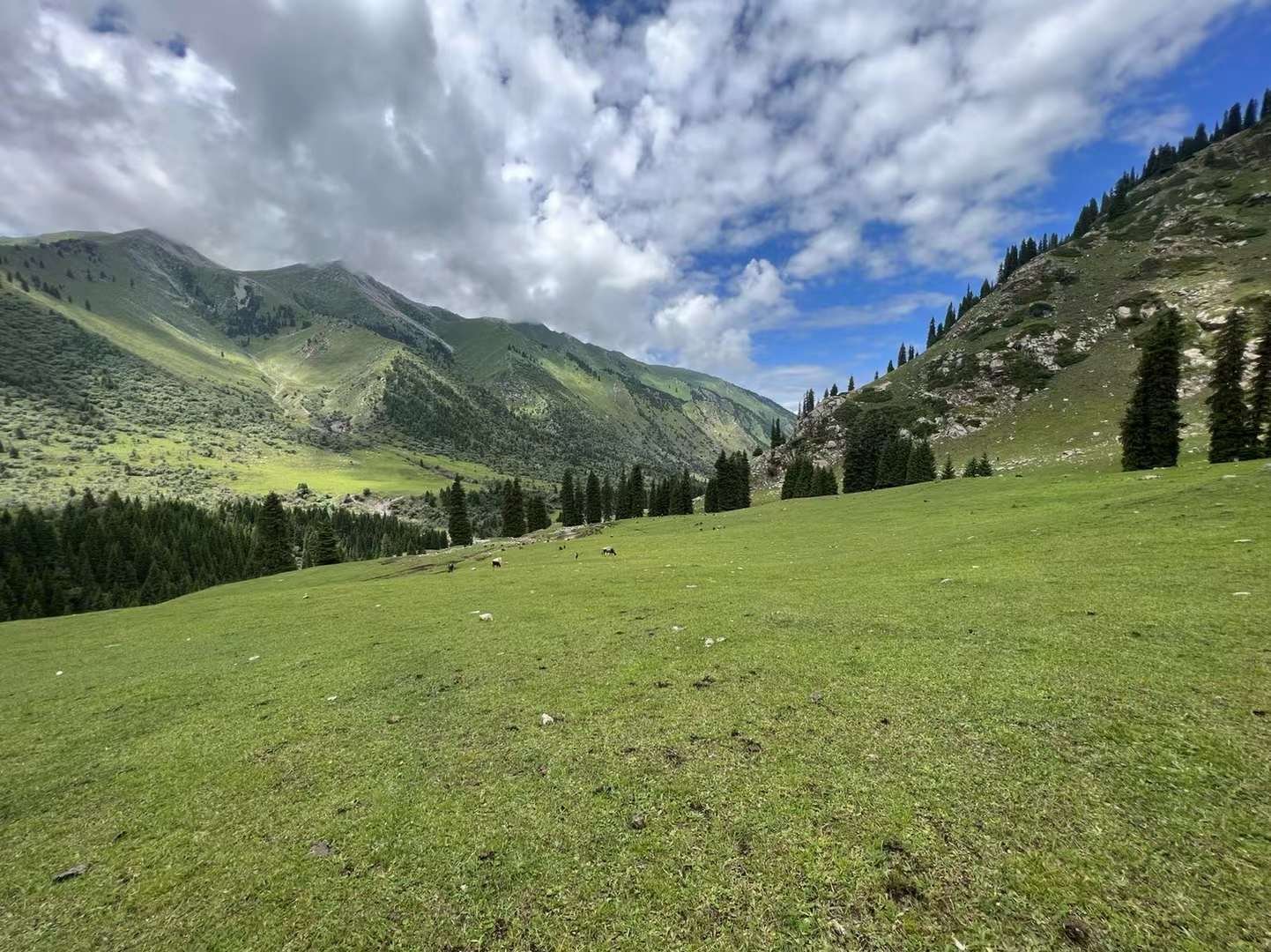
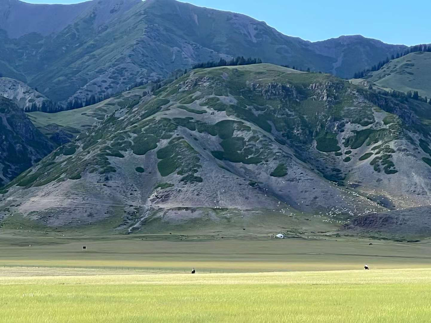
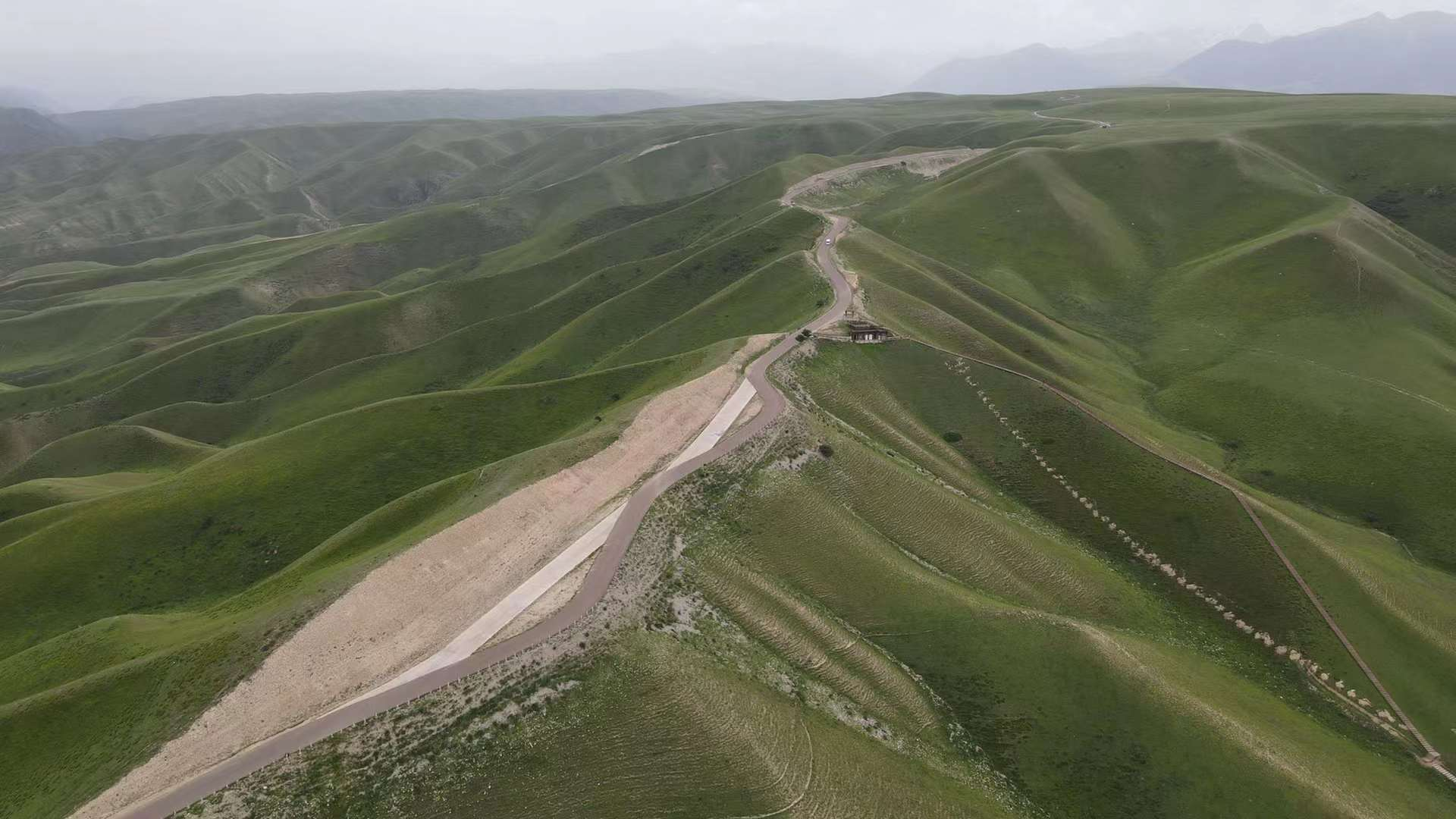
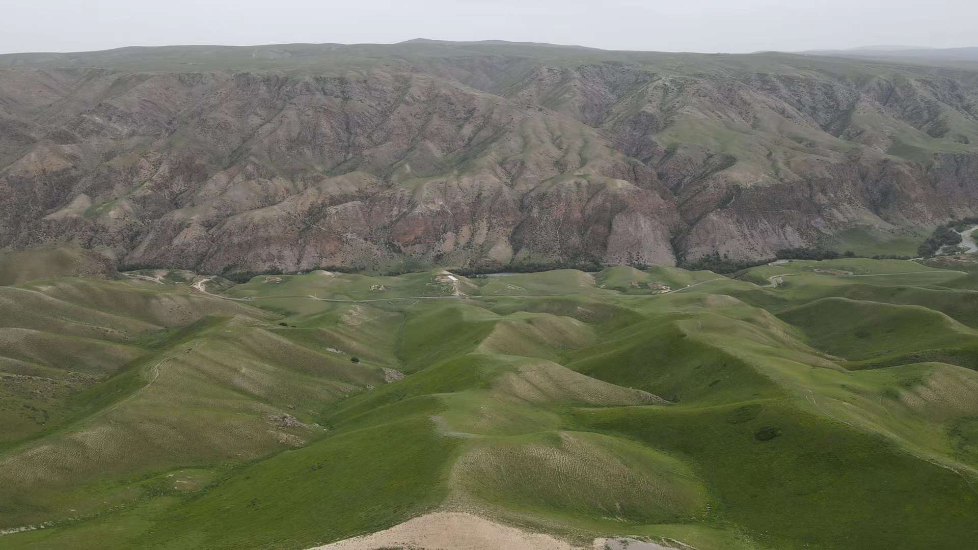
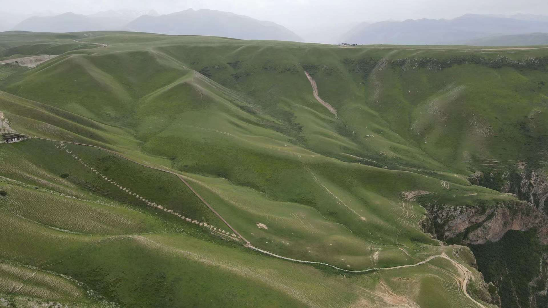
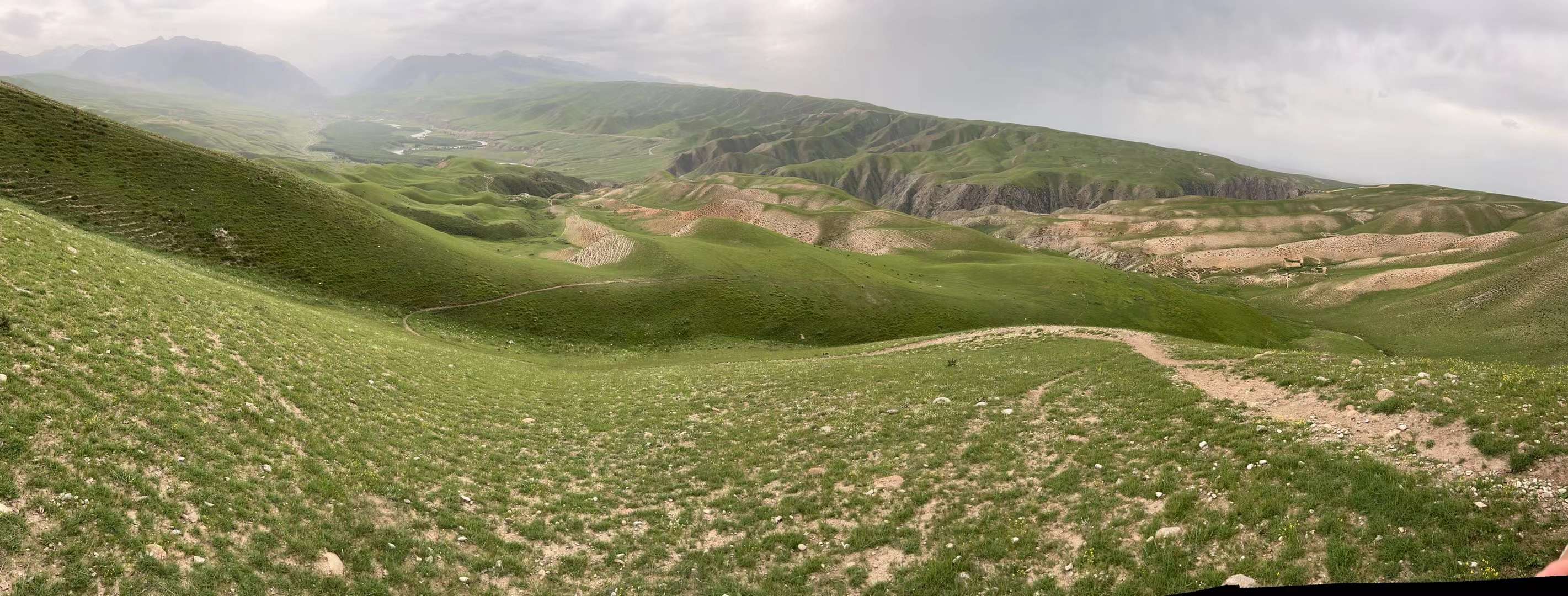
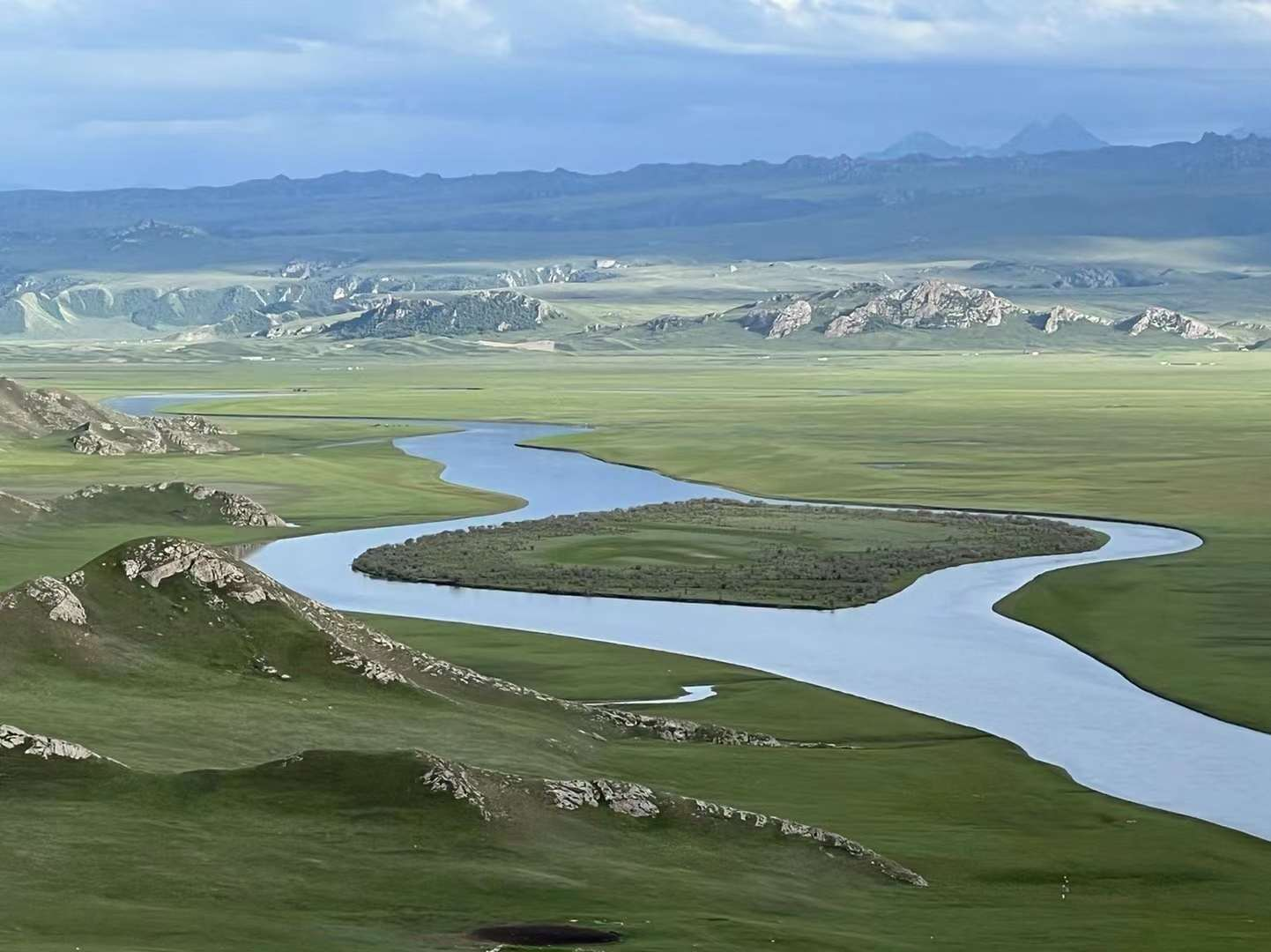
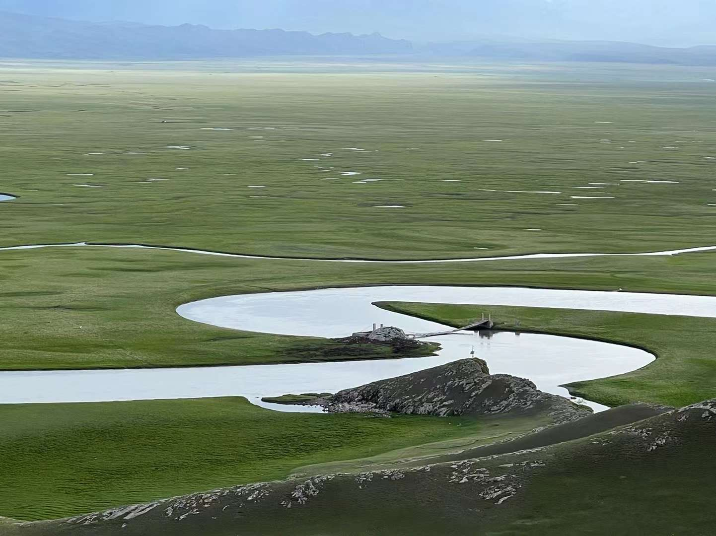
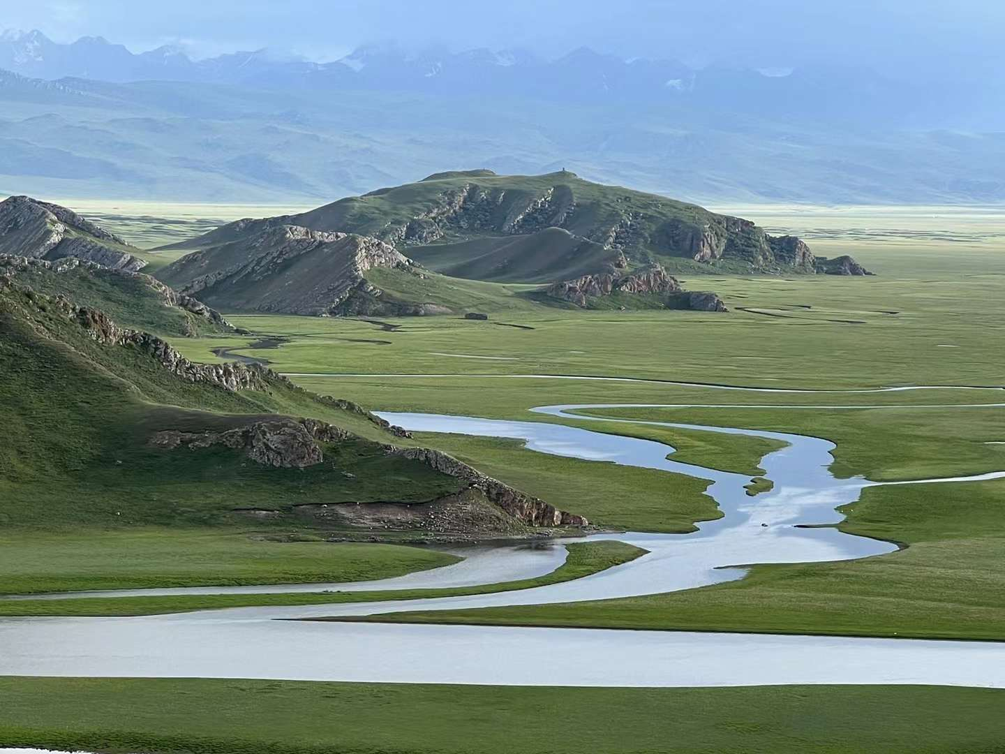
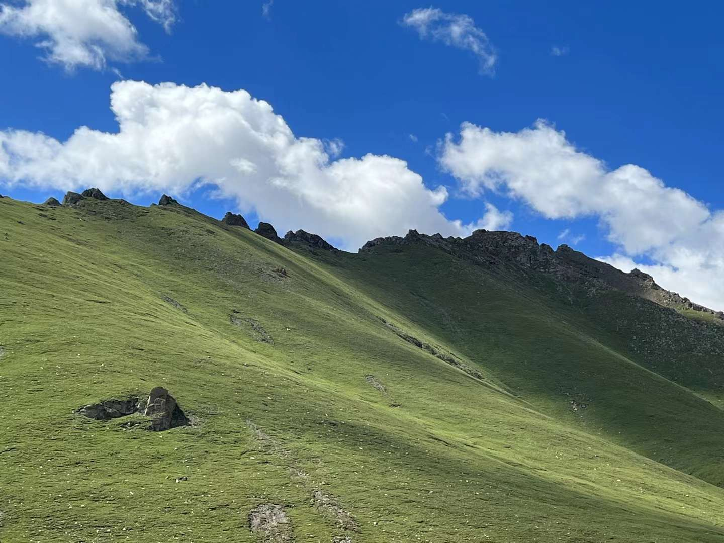
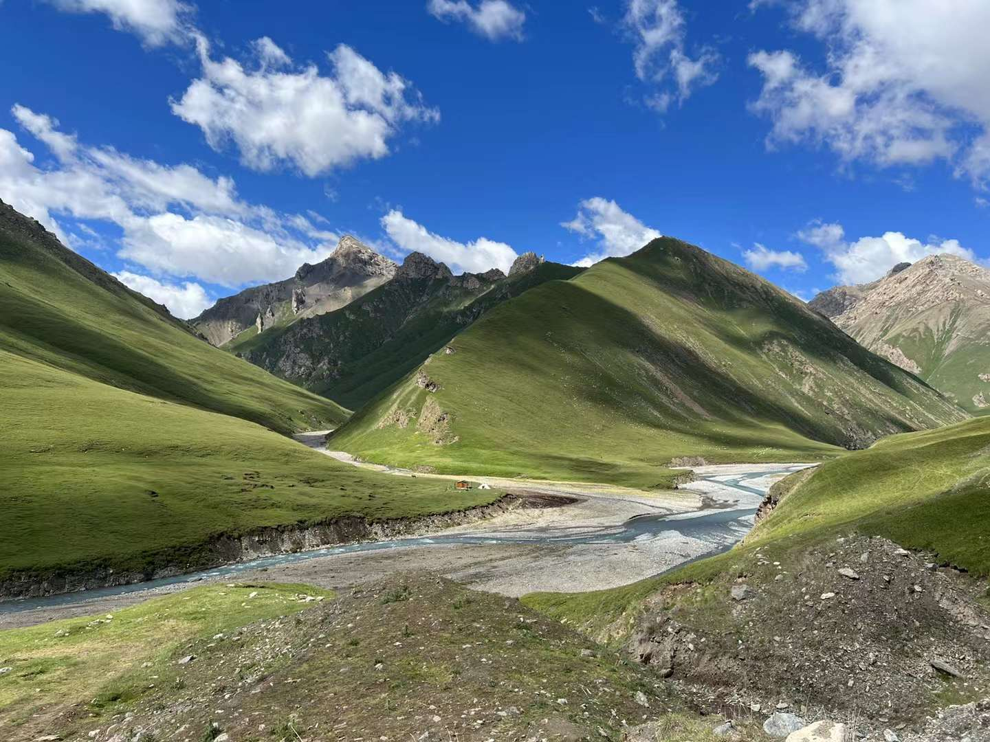
D6: Today's main itinerary: Play in Kush Village, Qiongtai. Riding horses to the milestone, Old Zhu and Li continued to walk along the Wusun Ancient Road, while other group members rode back. I kept walking ahead, and after a distance, the two of them also retreated. I am still moving forward alone. Arriving at an open grassland, before 14:00, I looked around and couldn't see any snow capped mountains (the tour guide had previously said they could be seen). I thought of setting up a drone to scout the way ahead and see how far it was to the observation platform they mentioned. There happened to be a large stone resembling a platform, about 2 meters by 2 meters and 50 centimeters thick, which happened to serve as a platform for placing drones. After flying for 500 meters and seeing the distance of about 20 minutes, I decided to finish this section. As expected, in about 20 minutes, we arrived at a large and oblique land, which was the observation platform. To the front right, the three mountain ranges are evenly divided into two valleys, resembling the shape of a W. Drone takes off again: Looking around, all the mountains are in view, with dark green cedar trees, verdant grass, azure sky, and fluffy white clouds, all intoxicating scenery. All fatigue is worth it! After eating a few pieces of naan to satisfy my hunger, I hurried all the way without even taking a sip of water, only then did I feel thirsty. Go outside at 14:40 and make an appointment to leave the village at 17:00. Getting what you wish for, the return journey is easy. It took less than 110 minutes to walk to the place where I stayed yesterday. Take care of everything and walk towards the village entrance. Take a group photo with two stones as a souvenir! Accommodating at Tex, it turns out that from above, Bagua City is so spectacular that you can have dinner in the old place of the ancient city. Then we strolled through "Li Street" together and tasted the century old handmade ice cream from Ili. We tasted it and said, "It's nothing special, there's no milk flavor!"
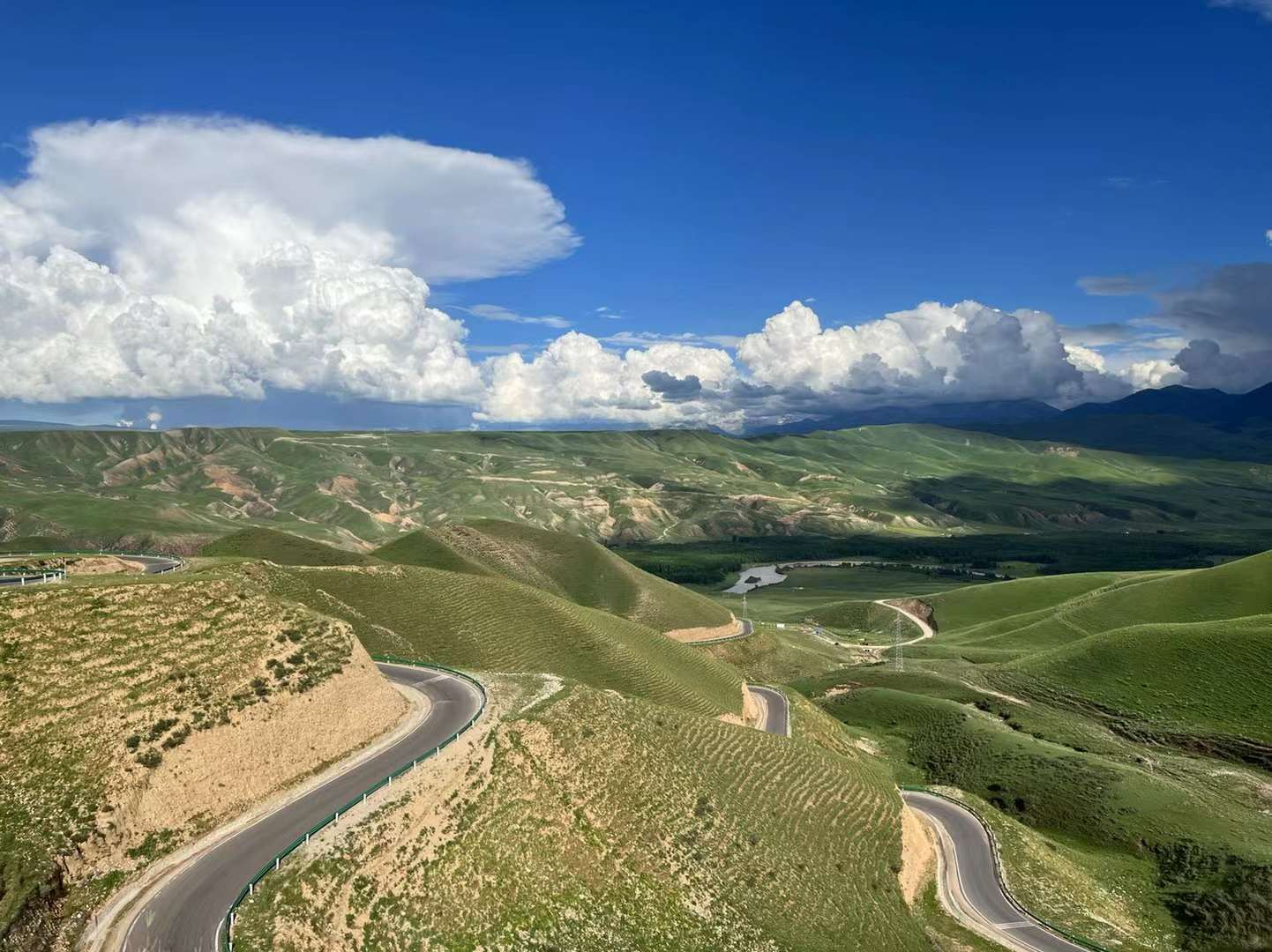
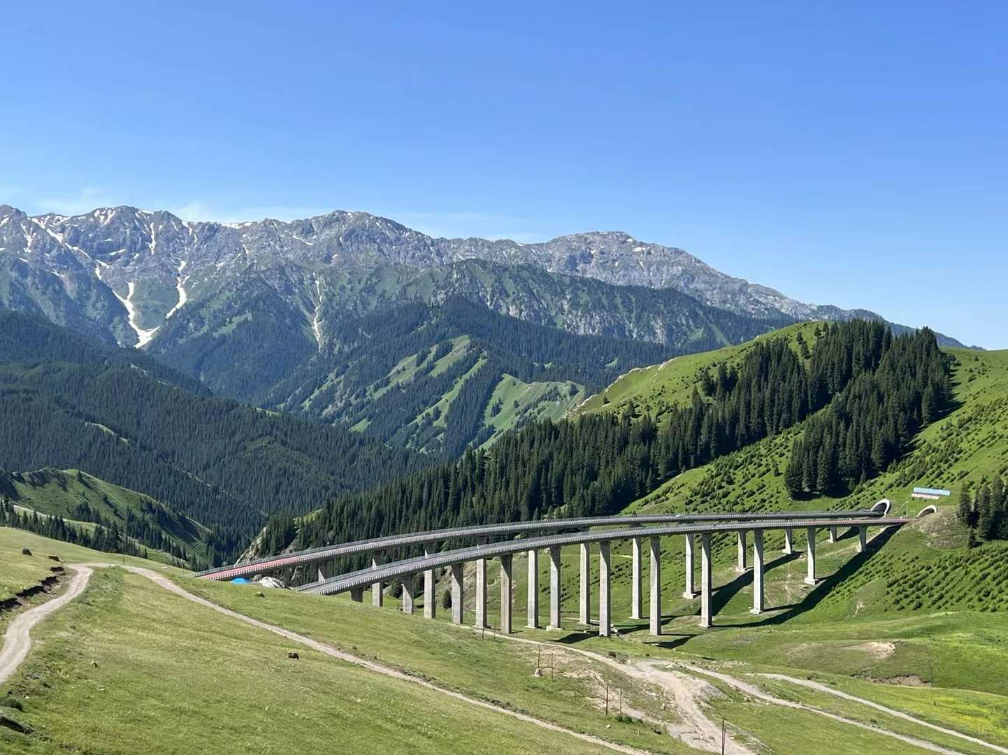
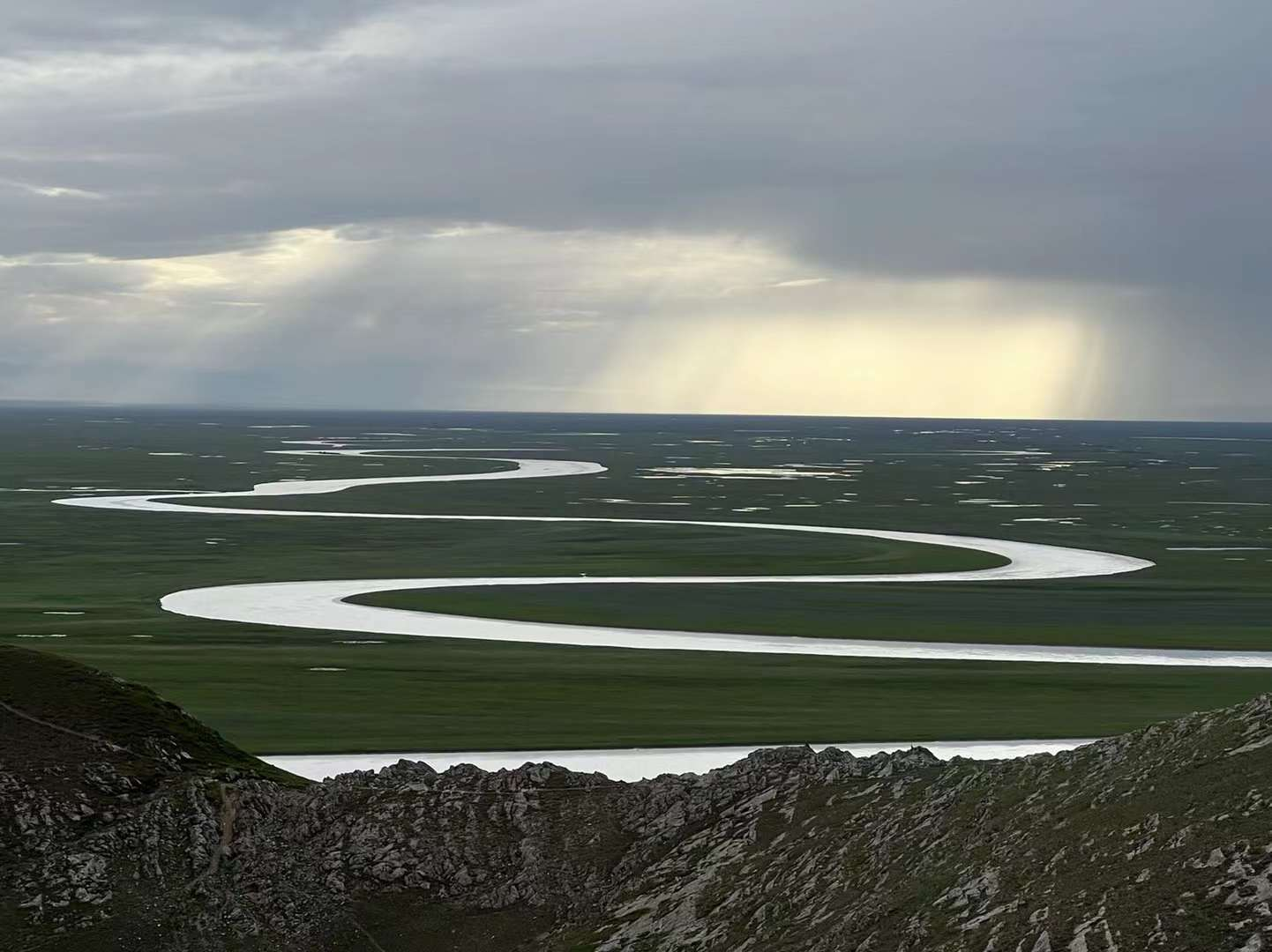
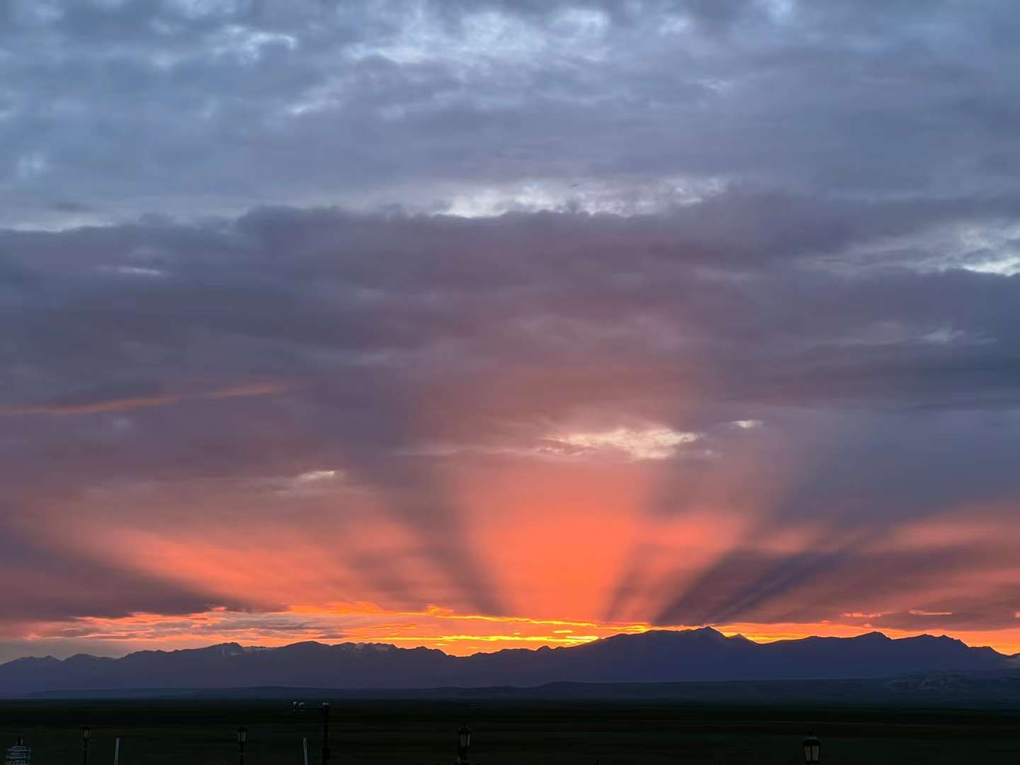
D7: Today, leave Bagua City and head towards Bayinbuluke, passing through the middle section of Duku Road. Passing by the road outside the "Nalati" scenic area, I remember the time I entered, it was quite a beautiful scenery! I was a bit disappointed to find out that drones are not allowed to fly here during the security check at the Bayinbuluke Tourist Center. At the top of the mountain, I finally saw "Bayinbuluke's nine curves and eighteen bends". This season, the sunset is on the right side, and I cannot see the so-called "nine suns". The sky had already darkened, so we went down the mountain. Prepare to live in the town.
D8: Today, repeat the southern section of the "Duku Highway". Returning to the old place, the most memorable thing is: the straight path in the middle of the grassland, the big and small dragon pools! Stay at the Pudong Holiday Hotel at night. Dinner at the "Old Boat Restaurant Making Fresh Fish" and having hot pot! The taste is very good.


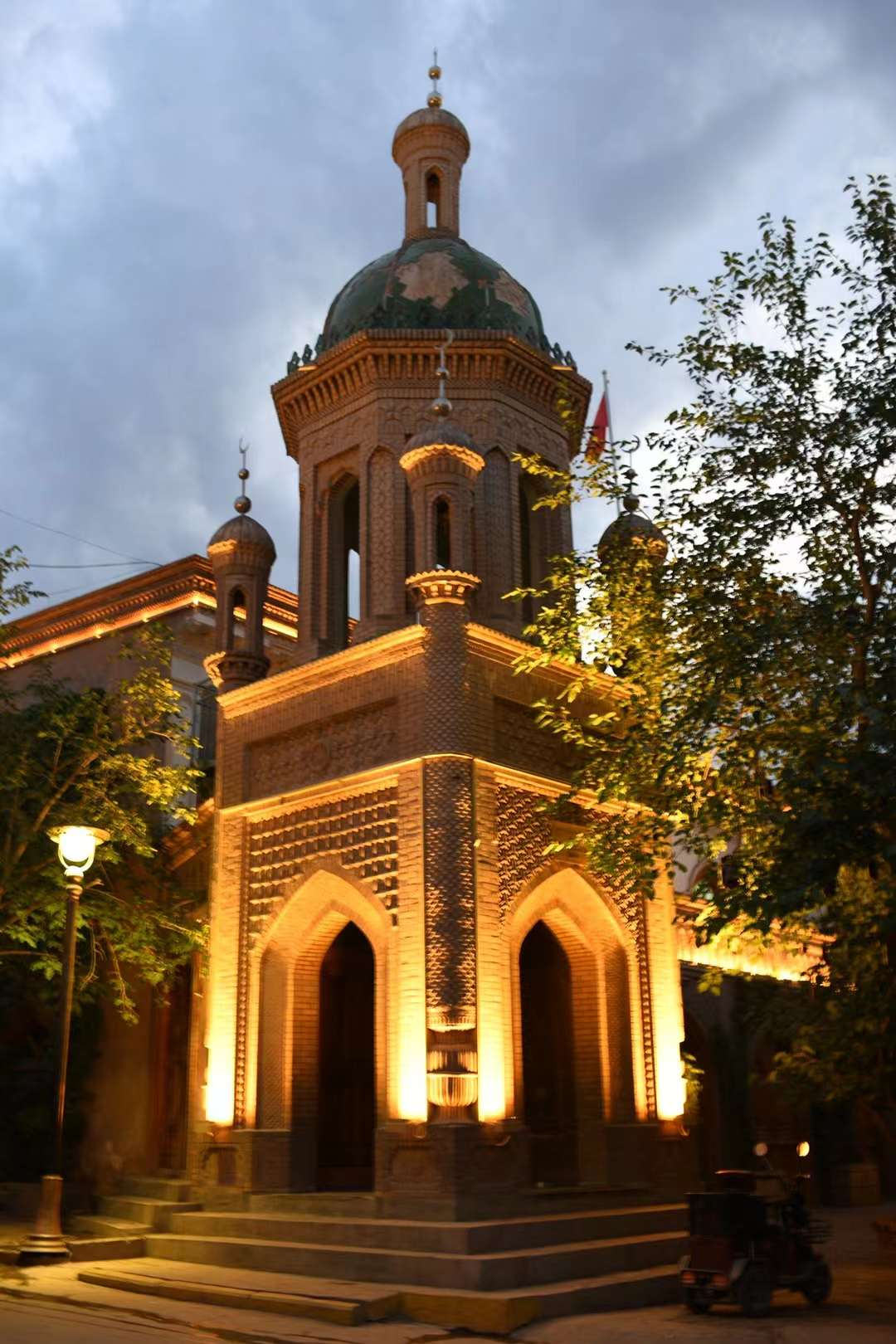
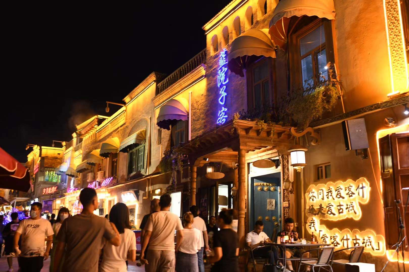
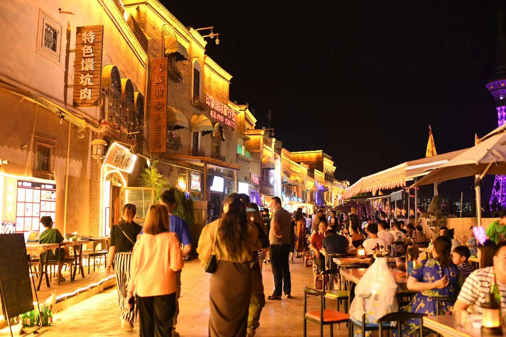
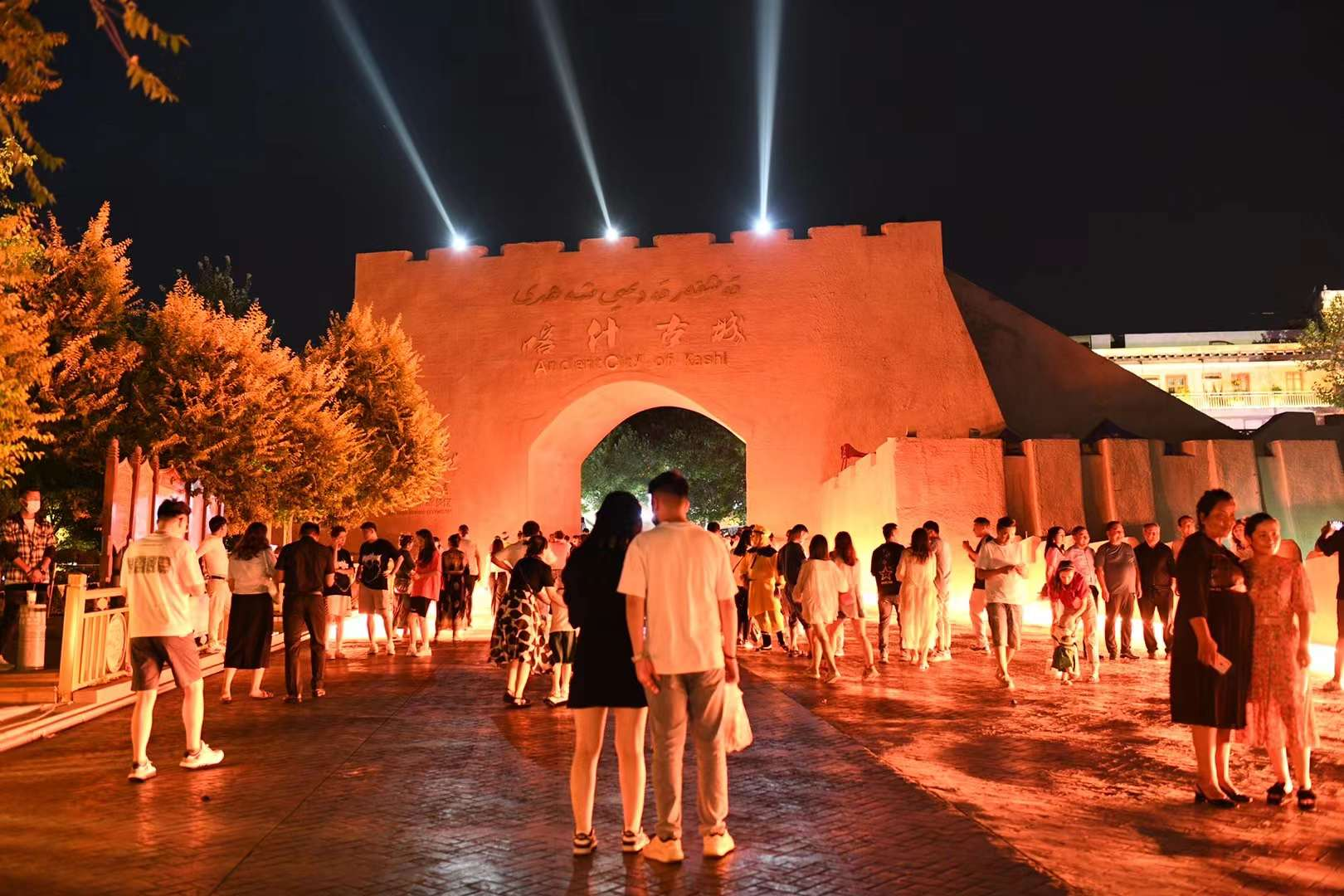
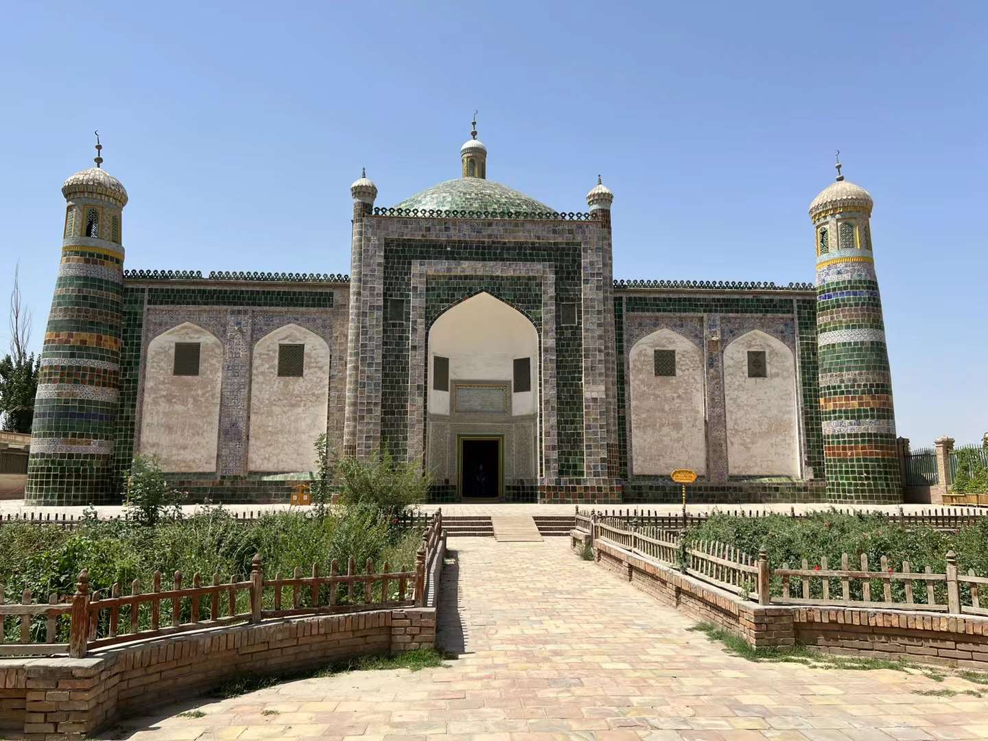
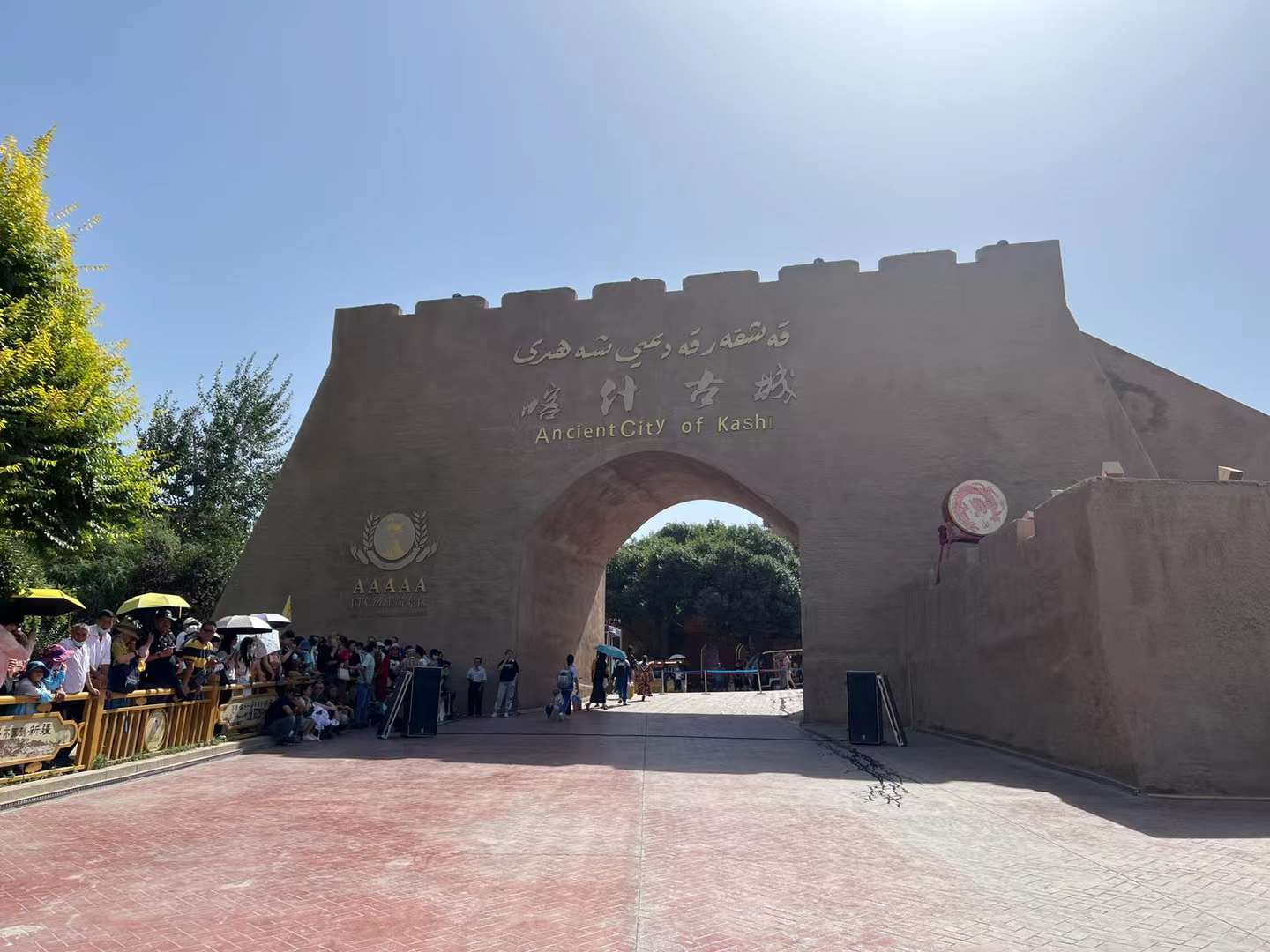
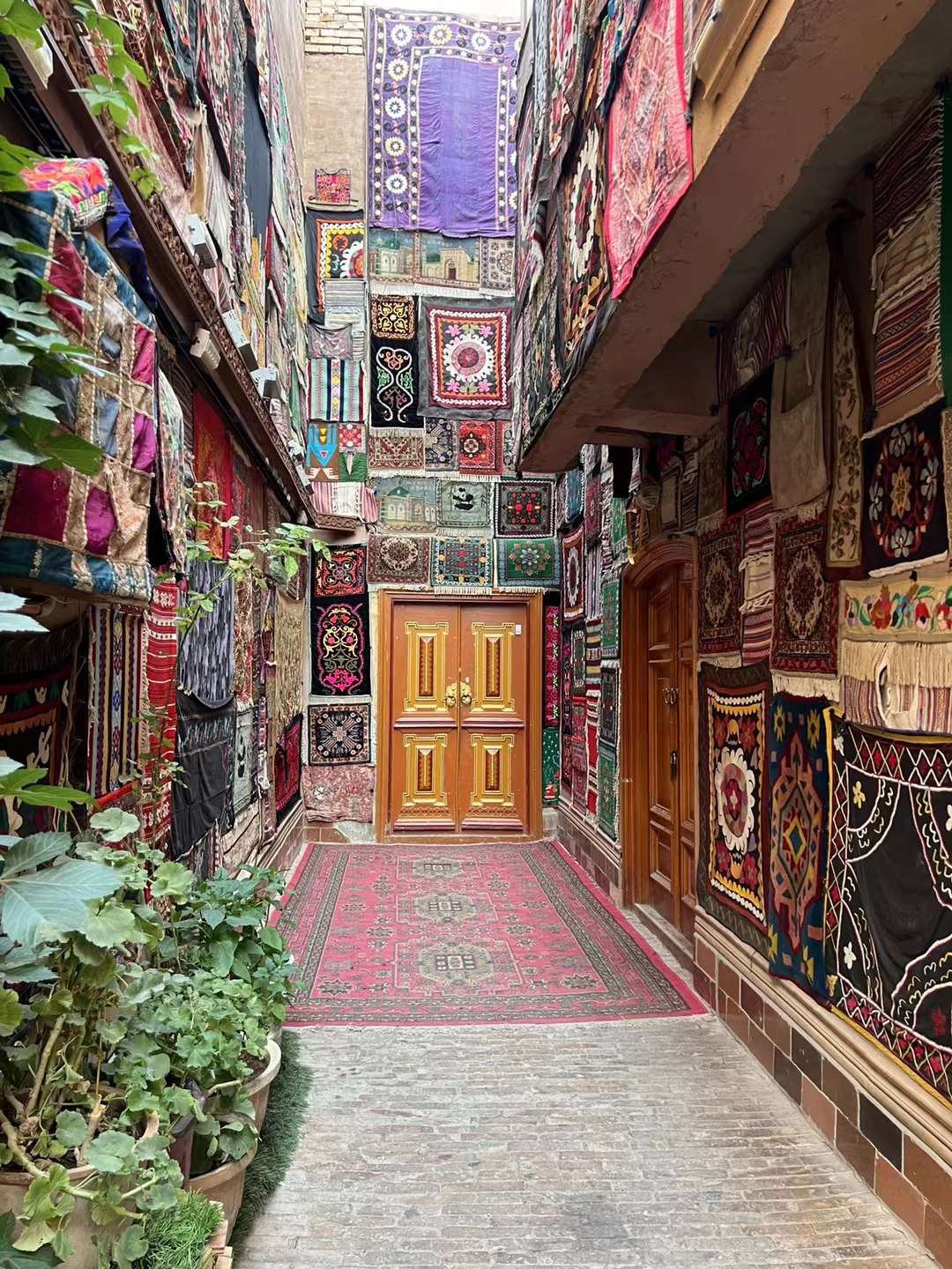
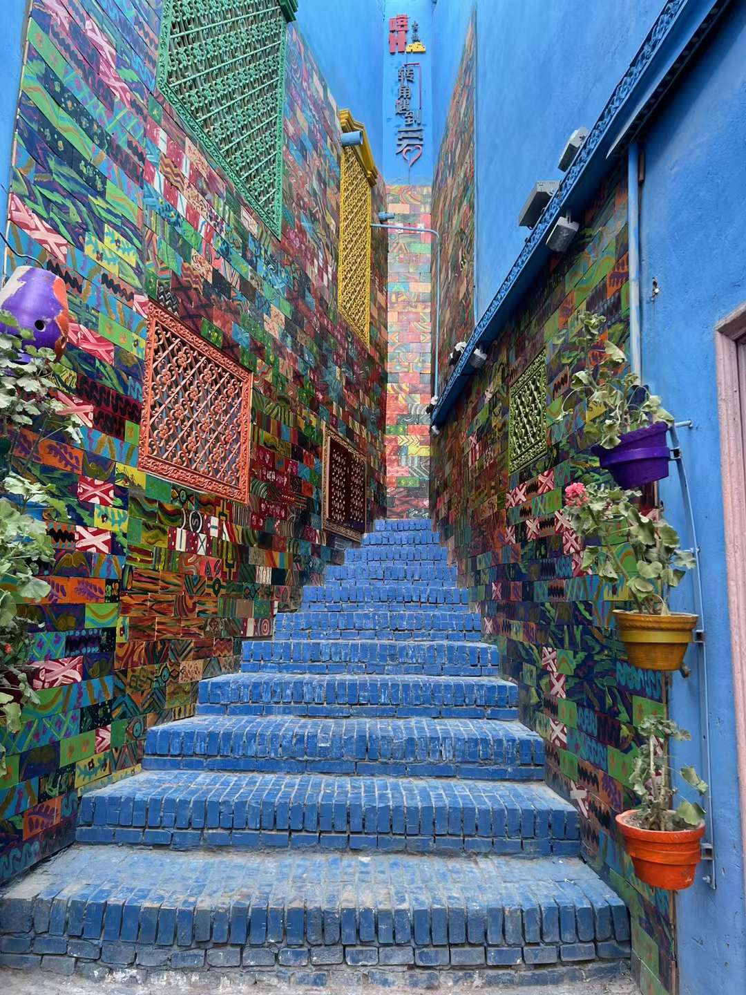
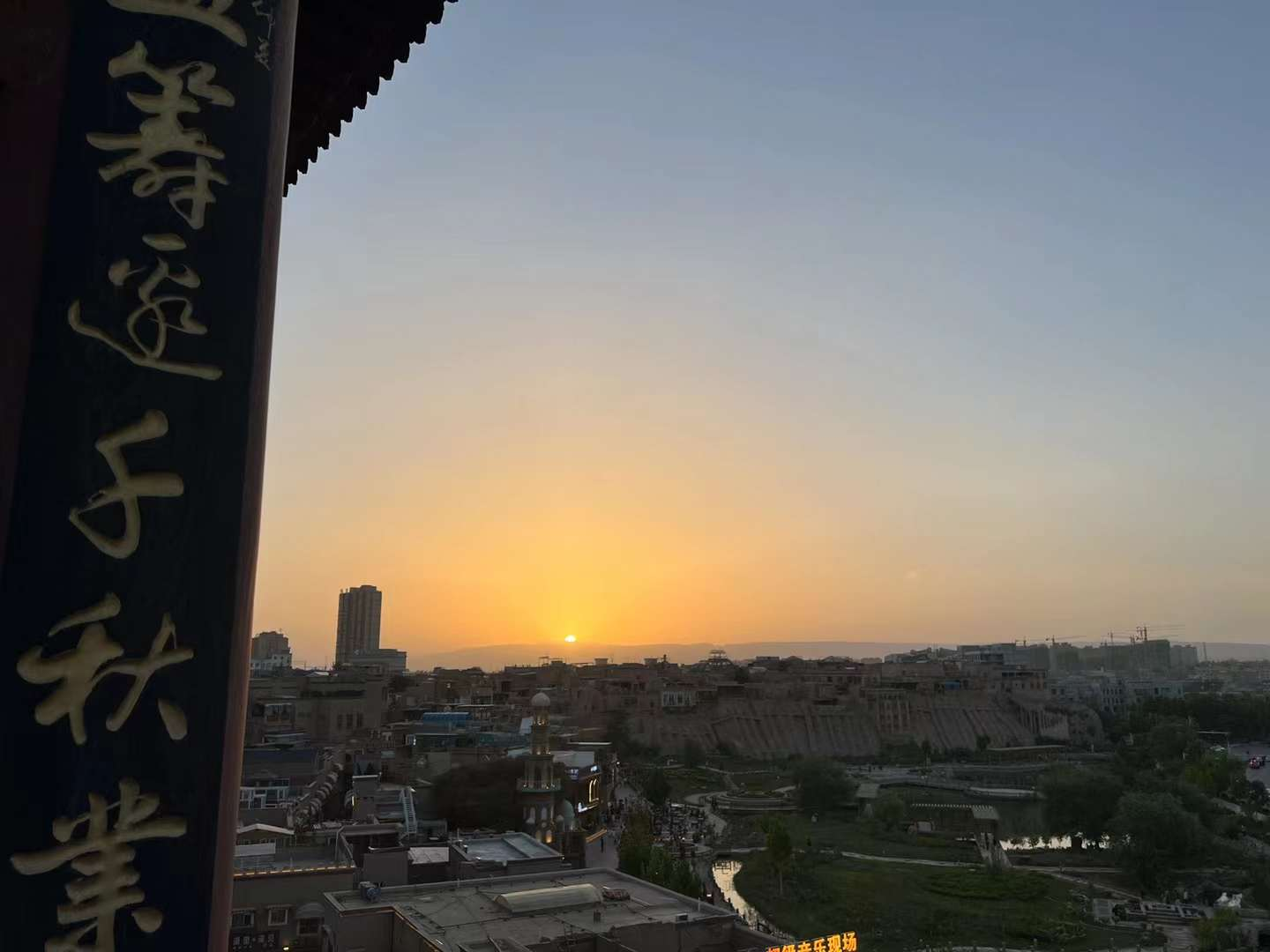
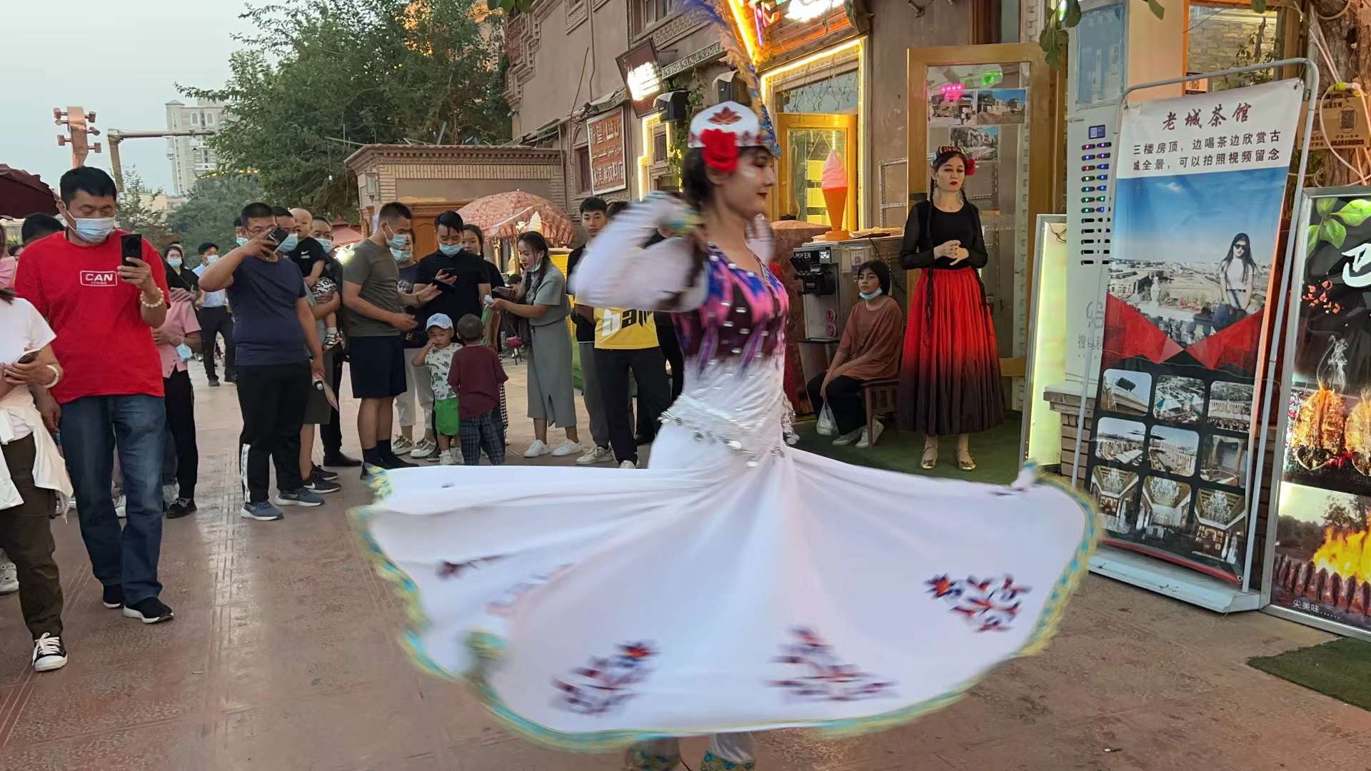
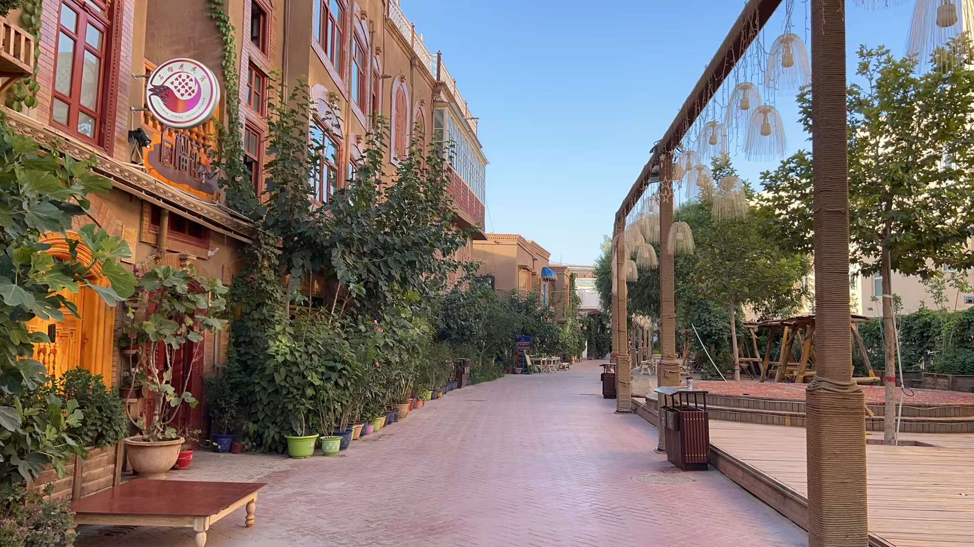
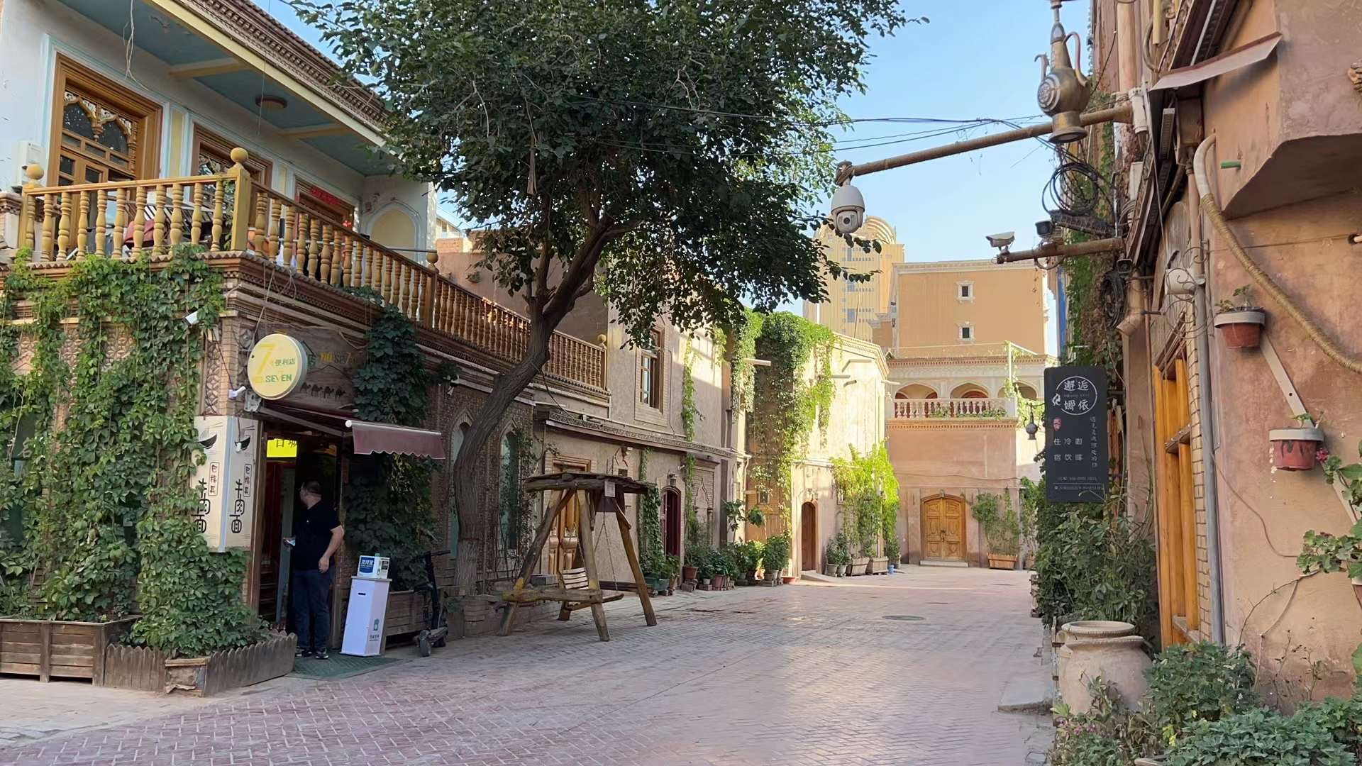
D9: Kashgar, meet you again! The "Muztag Peak Tour" in late June and early July 2018 visited Kashgar, with this as the starting point. Unexpectedly, the night view of Kashgar reminds me of the stunning ancient city of Montreal. Today, from Aksu City to Kashgar. The journey is about 450 kilometers, and it took nearly 7 hours to eat midway. Previously, at my suggestion, I booked accommodation at the Kashgar Nurlan Hotel. That time, I stayed here alone and didn't stay at the Tianyuan Business Hotel next to People's Square with the Sichuan Tibet team: I remember watching several matches until 4am in order to watch the World Cup late at night, and I was so tired the next day! Unforgettable memories! Mosque worship time, no visits allowed. Eating at the nearby "Haier Bag" restaurant: The dishes ordered were not very suitable: lamb offal was too fishy, pickled radish was too sour, and salad was too sour. Handmade yogurt, I think it's delicious, but they all think it's too sour. Only "specialty tea" feels good! Put a drone in "Etigar Square", turn on the plane, and connect the remote control one by one to know that this is a no fly zone. We have to give up and put the drone back in our room to explore the "Kashgar Ancient City". At night, walking to the east gate, I found out that there was a bustling bar street next to the city wall: people drank, grilled skewers, smoked hookahs, sang... The whole street aroused people's excitement. At the end of this street, it began to rain. I searched the map and walked back. Passing through several inner alleys, under the backdrop of the lights, there is a strong flavor - a taste that can only be understood but not expressed through the baptism of time. This reminds me of the ancient city of Montreal in my memory! Before leaving the ancient city, it was raining heavily, so I took shelter under a roof. The locals living here are running home one after another. After a while, a little girl wearing a red dress also walked over to take shelter from the rain and asked me to make a phone call. She murmured and called her father. After a while, she walked to the opposite door and picked up a small umbrella, then walked over and asked me to borrow a phone to make a call. I asked her what was wrong? She said the key was lost. The rain stopped, so I quickly ran outside and walked past the door. It turned out there was another little girl in a red dress. Leaving the ancient city, crossing the underground passage, and quickly returning to the hotel! Tonight, I truly understand that not having been to Kashgar is equivalent to not having been to Xinjiang; Having never been to Kashgar is equivalent to not having been to Kashgar!


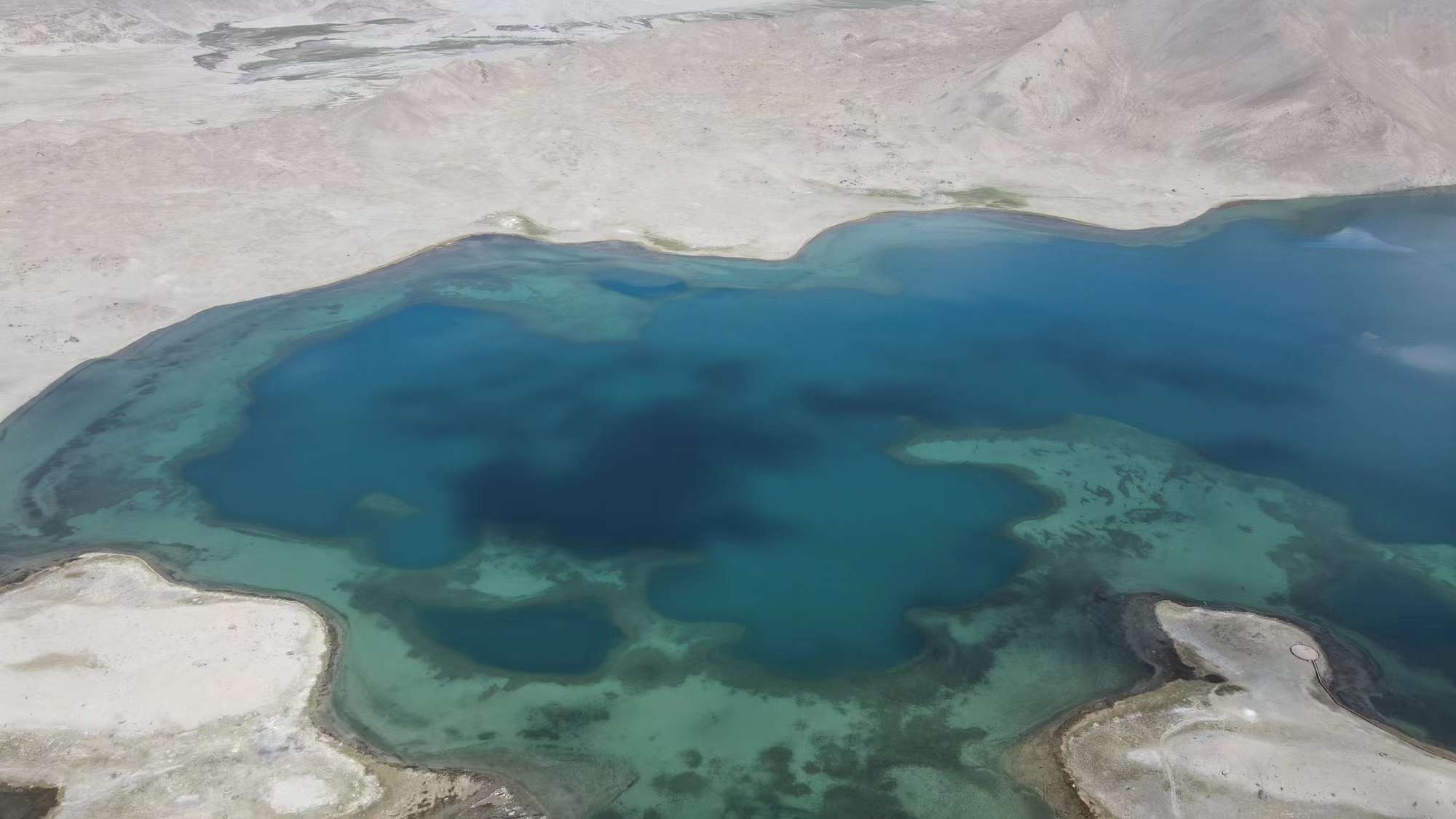
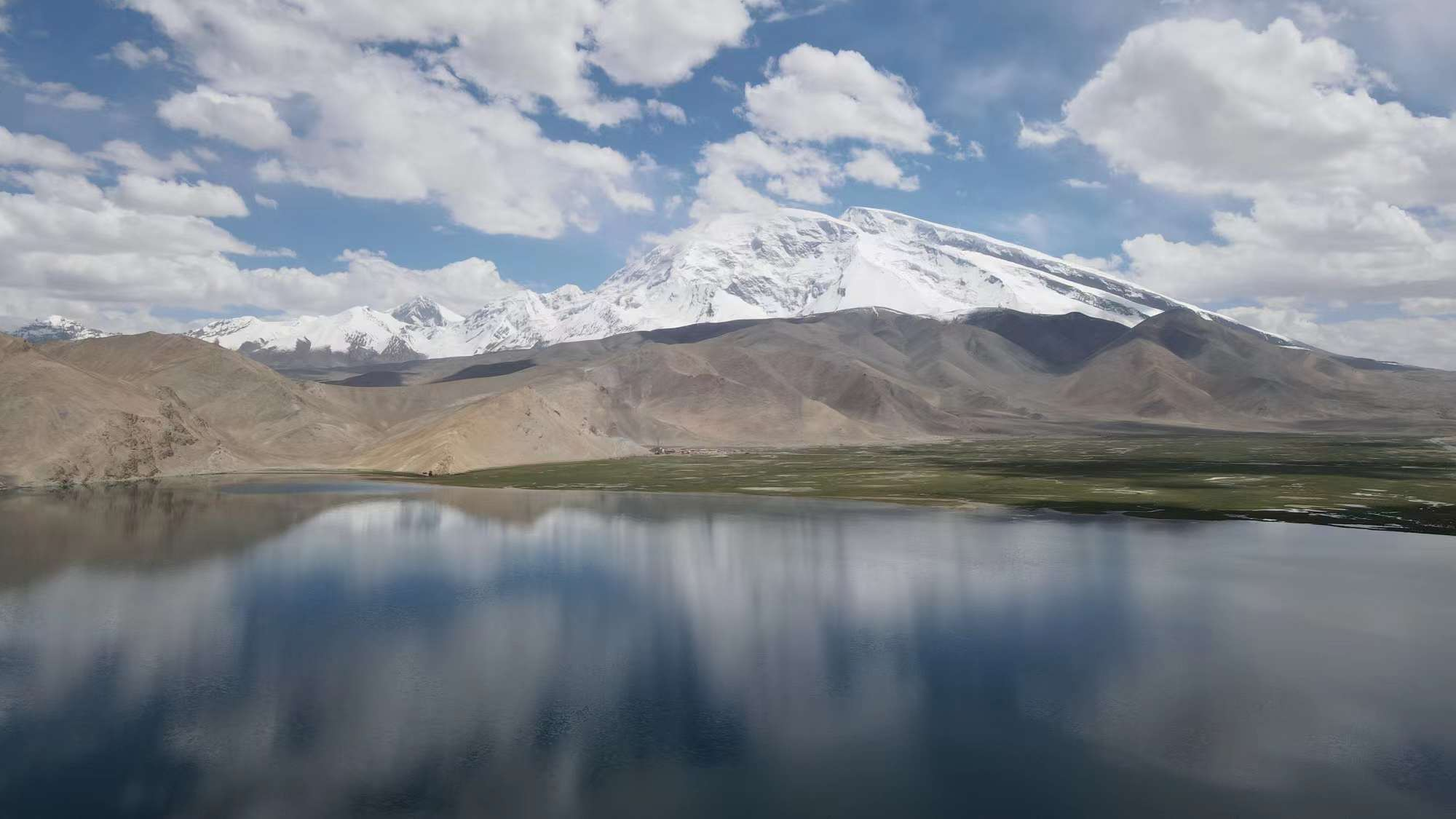
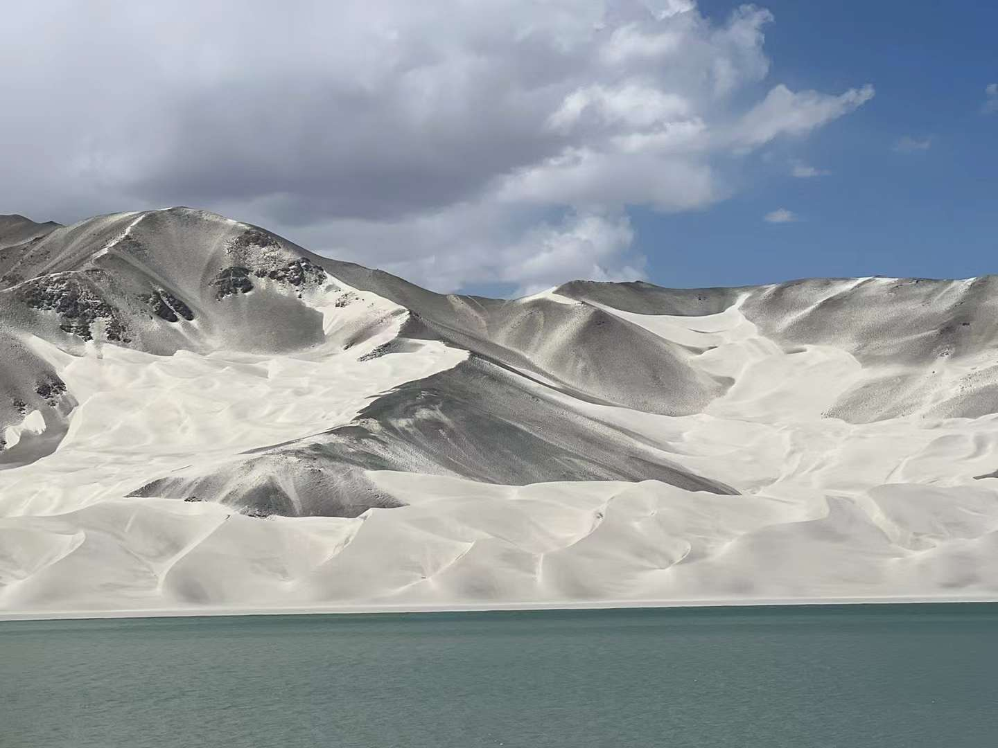
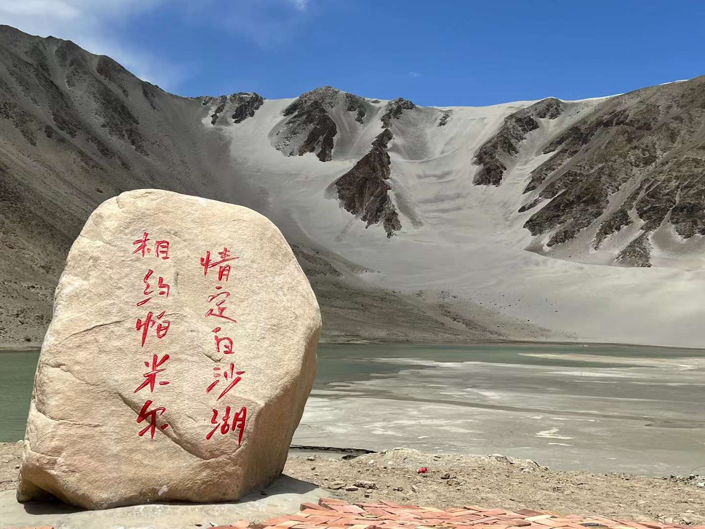
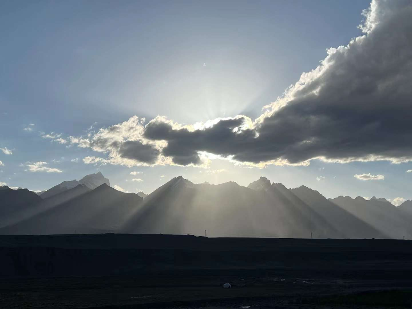
D10: Today, we once again embrace the "Muztag Peak" from Kashgar to Taxian, which is nearly 300 kilometers away. It was originally a 4 and a half hour drive, and we stopped and walked, ate, took photos of the scenery, and flew drones. It took us more than 7 hours. Halfway through, I saw Baisha Lake and Karakul Lake. Halfway through "Kezhou Glacier Park", I stopped for a while and walked into a store selling tourist souvenirs. A little girl with a smart and capable appearance replaced her mother in selling goods. I asked her what grade she was in, and she didn't have the timidity of a child facing strangers at all. She blinked and replied, "I was in fifth grade in Ta County.". I made some bargaining and bought a few small toys. Tell the landlady: Your daughter is very beautiful. The boss said I'm also very beautiful! I said she is more beautiful than you. The old lady sitting inside the counter also laughed. Let the little girl stand and take a photo, after all, she is a child and a bit nervous when facing the camera. The photo is not as beautiful as a real person. Rushing for lunch, Baisha Lake looked at the roadside for a while but didn't go in. The faint green lake water contrasts with the black and white infiltrating Baisha Mountain behind, like a serene Chinese landscape painting, somewhat unique. Lunch at a newly built resort in Brunkou Township. There is not much scenery to see behind Baisha Mountain. There aren't many customers at this time, so we also chose a room on the second floor. A photo on the hallway caught my interest and I asked the waiter, saying it was "Ancient Stone City" in Ta County. The waiter is very young, and seeing the shyness in her speech and behavior, she couldn't help but think of her own child. She turned out to be only 20 years old, dropped out of school and started working when she was in her sophomore year: because she was the eldest and wanted to lighten the burden on her family, there were also younger brothers and sisters below. I thought to myself: Is it a preference for boys over girls! After dinner, walk towards Lake Karakul. From far to near, I finally saw the once unforgettable experience of Mount Mustag again. While driving, I couldn't help but turn my head to the left and look far into the world famous "Father of Glaciers". The bits and pieces of that impulsive adventure journey surged in my heart... All the hard work, trials, and tribulations during the process were nothing but experiences! Stay at the Europa Garden Hotel in Ta County and have yak hot pot for dinner at Yiwei Yak (Xindian). Next to it is a long square called Qishi Square. Stroll around the square casually after dinner. The most regrettable thing this time is that I couldn't travel with my family. Video conversation to share the moment when the sky is still bright at 22:00 on site.


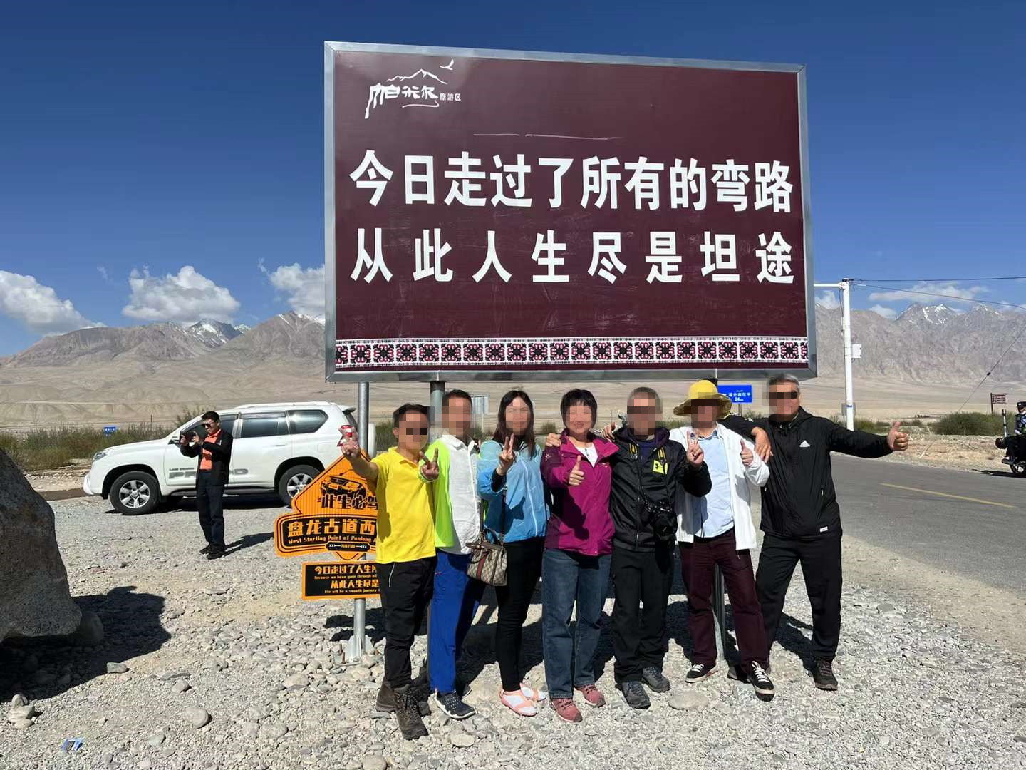
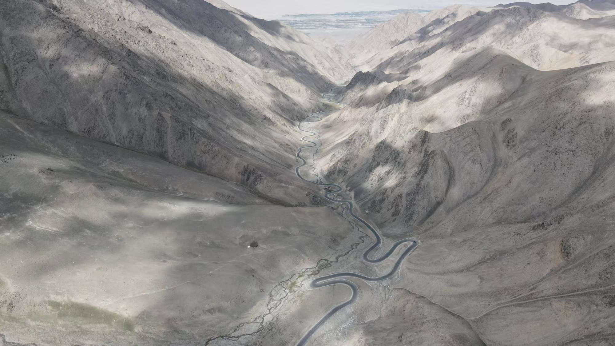
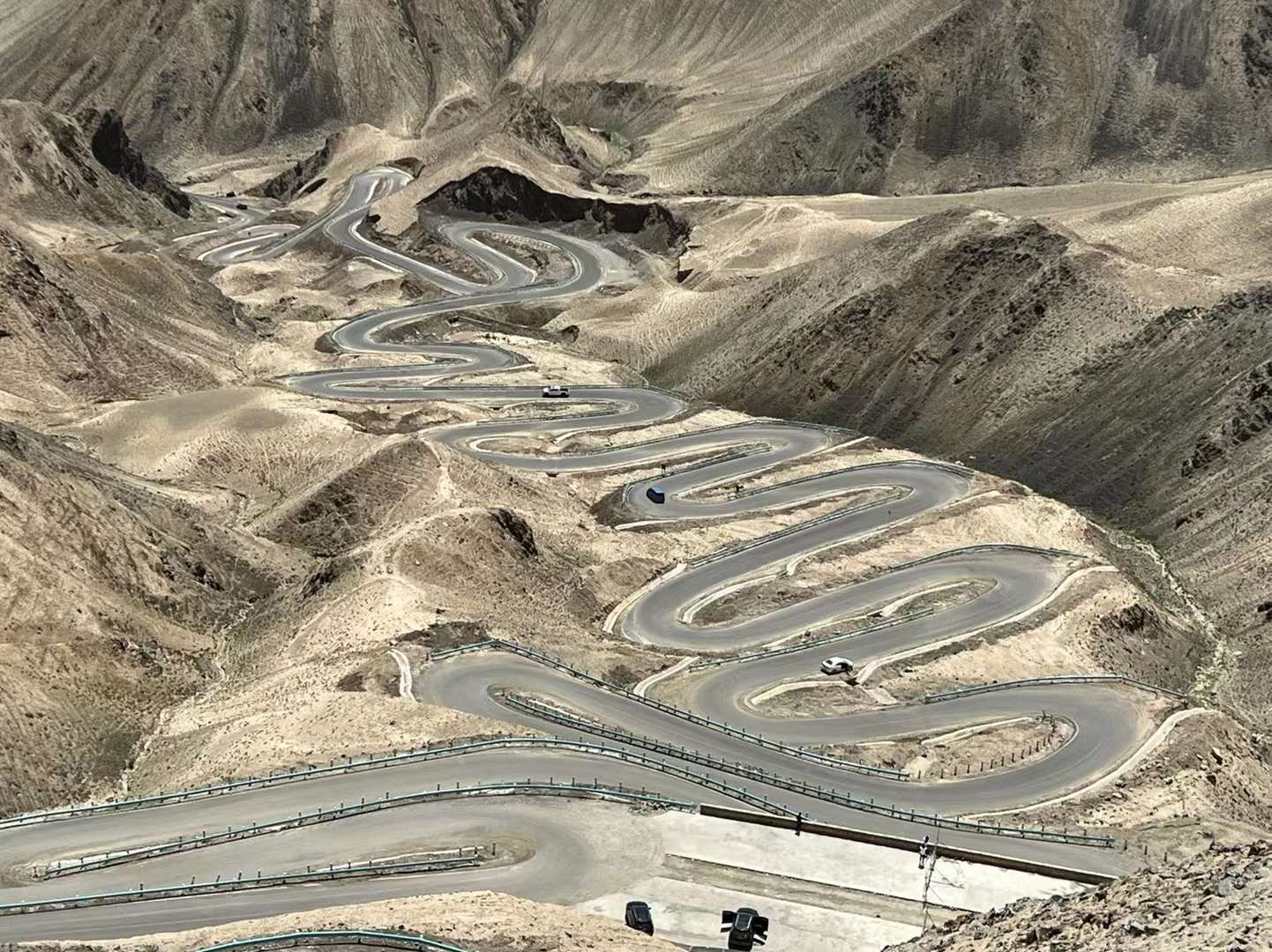
D11: Today, I finally drove through the famous "Panlong Ancient Road". In fact, this is a road that was only completed and opened to traffic in 2019. It is a passage connecting Ta County and Waqia Township. In today's era of highly developed networks, a road that has accidentally become an internet celebrity! We emerge from the big dragon and the small dragon. After taking a photo at the entrance check-in point and preparing to depart, I realized that the car key battery was out of battery and could not start. A sister who was driving a Xinjiang license plate voluntarily came to guide and said to bring the key close to the chip sensing position to start the car, but unfortunately, she still couldn't start the car. Finally, put the key battery of the other car into the car. This time, we can't stop the fire all the way. The big pan dragon is ordinary, and the small pan dragon is the essence. My fellow passengers were afraid that the car would shake too much, so I slowed down a bit. Arriving at an open highland, fully utilizing the advantages of off-road vehicles, retreat on the slope and charge up to a high platform, where you can see the snow capped mountains and continuous mountain ranges in the distance. Next, walking towards Xiaopanlong, at a rugged observation spot, I saw a series of elbow bends of Xiaopanlong extending along the steep mountain towards the foot, which was very spectacular. I first set up the drone for a while, and all the angles I wanted to take were taken. Lao Zhu had already climbed over the Luanshi Mountain at the end of the observation boardwalk, but his wife scolded him for not caring too much. I guided the drone over there and saw that there was still over 30% battery left, so we walked over to take pictures together. This angle is indeed good, and the remaining 12% of the battery quickly landed one by one. I wanted to grab it from the bottom of the plane, but it couldn't. In order to be safe, I didn't let the oars hurt me. As I reached up, the plane suddenly jumped up and finally found a place just enough to land in the midst of the chaotic rocks. I successfully landed and left with all my heart! Former tour guide Xiao Zeng has found a place to have lunch at a music restaurant in the "Why Are Flowers So Red" scenic area. Coming out of Panlong since childhood, all the way to the "Why are the flowers so red" scenic area, there were lush green plants and trees all along, giving off a feeling of a paradise. The couple, Agao and his wife, sang karaoke well and didn't even bother to eat. After that, Agao and his wife went back to Ta County to rest, and the five of us went to another place to stroll... After 20:00, we asked them to have dinner on their own. It should be 22:00 when we returned to Ta County! Sure enough, the time is about the same: mainly there is a video surveillance device every 300-500 meters on the road, with the words "Kong Dao Jian x" KDJ1000XXX written on it. I don't know what it means, but for safety reasons, I'll drive at a speed of 80 kilometers per hour. We five had plateau cold water fish (seemingly trout) and hot pot for dinner. It's almost 23:00, the sun has just set.
D12: Today, starting from Ta County to Shache County, we took the ancient road "Tasha Ancient Road" with a long history. The introduction found online is like this: Tasha Ancient Road was originally known as "Kaqun Ancient Road", known as a paradise on earth, with both human fairyland and uninhabited, it can be said to be "heaven for the eyes and hell for the body", with a history of at least 1000 years.
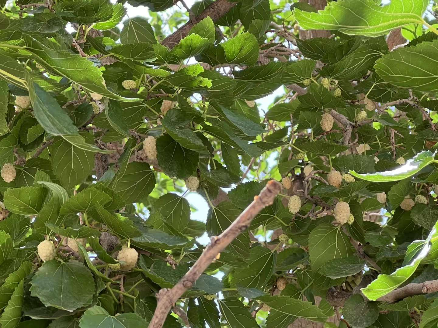
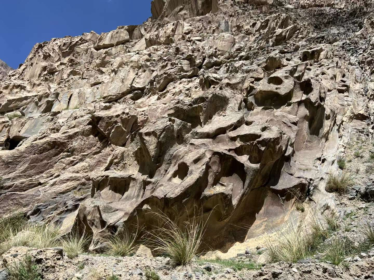
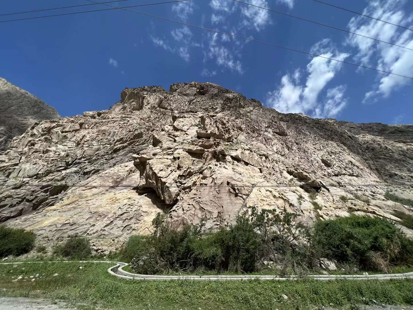
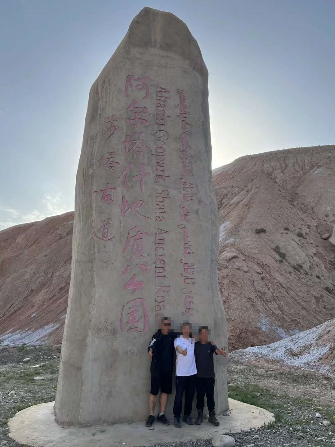
It is less than 300 kilometers from the northern end of Tashkurgan Tajik Autonomous County to Shache County. This ancient road goes deep into the hinterland of Kunlun Mountain and Pamirs Plateau. It integrates landscape and culture, almost contains the essence of Pamirs apricot flowers, and at the same time has many elements such as snow mountains, canyons, villages, pastoral areas and Tajik villagers. According to the records of Master Xuanzang, "From then on, I went east to Congling Donggang, climbed Weiling over Dongdong Valley, and the creek path was treacherous with wind and snow. I traveled more than 800 miles from Congling to Wusong Kingdom." (Congling is the Pamir Plateau, and Wusong Kingdom is today's Shache). Also: Various beautiful photos online about Tasha Ancient Road. Reality - what we see on the Tasha Ancient Road today is not so beautiful and desolate, with steep mountains, rugged roads, and full of danger. It is the true existence! Flowing water will make you unable to prevent the whole car from bouncing up; Randomly falling rocks and the width of the damaged protective fence are testing your driving skills; The reaction of the bike on the edge of the cliff, bending at the elbow and rushing towards you, is that the towering rocks on the mountain are provoking your nerves. Everything is like risking your life. I have driven many, many, many... mountain roads, this is the most difficult one to walk! Fortunately, I feel relaxed. If it weren't for my fellow passengers constantly shouting for help to slow down, I could have driven faster and had lunch midway. I saw white mulberries and picked them on the tree and ate them immediately: they were very sweet and melted in my mouth. After finishing the sticky candy in my hands! After dinner, it's already 15 o'clock, keep moving forward. After walking the ancient road, I saw a national geological park under construction - Shatagu Road Altash Geological Park. Stay in Sha County at night. Departing around 10:30 in the morning and eating in Shache County at 22:30 in the evening: barbecue and small seafood! Unforgettable driving experience staying at a homestay: Shache Silk Road Inn.
D13: Today, I will return to Kashgar from Shache. I hurriedly visited the "Xiangfei Garden" and settled in my accommodation. After getting a nucleic acid test, I went to the ancient city for a stroll. Thick yogurt, various ice drinks, and a refreshing and refreshing "New Blue Sky Pigeon Soup Shop" were all enjoyed! Afterwards, go to the ancient city and see the last sunset! On this day, I started to feel tired. I strolled around the bar street in the east gate city wall and sat down at "Atamiras Sixth Generation Brazing" to drink beer: wheat white, black lion, prince tea, all good! Kashgar, I've met you again the most. This is my last night. Cheers.


D14: The morning in Kashgar Ancient City is particularly peaceful! When it was time to say goodbye, there was a faint feeling of reluctance. Goodbye, Kashgar! The security check at Kashgar Airport is the strictest I have ever encountered: all the batteries of the camera and drone were removed, not to mention the shoes were taken off, the cash had to be opened and checked, and my companions didn't need it for 5 minutes. It took me nearly 20 minutes to transfer in Urumqi, and it was quite smooth. Depart at 15:00 and arrive at Shenzhen Airport at 21:41. There is visual entertainment available on China Southern Airlines flights to relieve boredom. At this moment, a little interesting thing happened: I don't know which country two of the languages are from. When I asked the flight attendant, surprisingly, none of them knew! Am I making things difficult for others? Alright: Good times are always so short, looking forward to a happy journey next time! Work hard to move bricks!